Fondi night lights from space
Night Light of Fondi (Latium) from space (Italy) Src. Average luminocity for 10x10km area is 24.0969% and for 50x50km: 11.2321%.
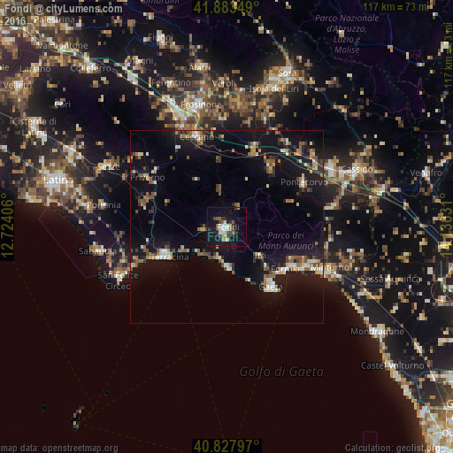
Analysis of Fondi night lights 2016
Square area 10x10 km:
 3.4%
3.4%90-99
4.93%80-89
1.19%70-79
0.68%60-69
3.06%50-59
3.91%40-49
3.91%30-39
4.08%20-29
2.72%10-19
34.18%0-9
37.93%Square area 50x50 km:
0.69%90-99
1.68%80-89
0.86%70-79
0.99%60-69
1.34%50-59
2.14%40-49
1.6%30-39
1.71%20-29
2.2%10-19
14.04%0-9
72.77%Clear (daylight) street map image can be seen on geolist.org.
Map coordinates:
41° 53' 0.6" North, 12° 43' 26.6" East
41° 21' 28.3" North, 13° 25' 37.8" East
40° 49' 40.7" North, 14° 7' 49.1" East
Some cities around Fondi sort by population:
• Terracina
17 km =10.6 mi,  244°
244°
• Formia
18.9 km =11.7 mi,  126°
126°
• Gaeta
20 km =12.4 mi,  143°
143°
• Ceccano
25.2 km =15.7 mi,  341°
341°
• Priverno
24.2 km =15 mi,  301°
301°
• Itri
11.4 km =7.1 mi, 131°
• Pontecorvo
22.9 km =14.2 mi,  60°
60°
• Ceprano
22.1 km =13.7 mi,  19°
19°
3176843 (p: 26,634)
Sources (retrieved 2019-11-25):
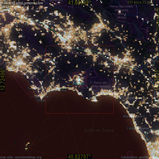
» Earth at Night: Flat Maps 2012, 2016