San Giovanni Lupatoto night lights from space
Night Light of San Giovanni Lupatoto (Veneto) from space (Italy) Src. Average luminocity for 10x10km area is 70.4492% and for 50x50km: 40.3608%.
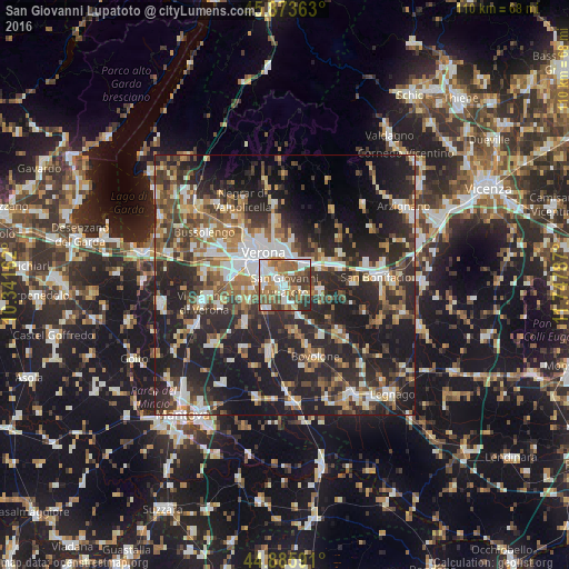
Analysis of San Giovanni Lupatoto night lights 2016
Square area 10x10 km:
 18.89%
90-99
15.08%80-89
4.44%70-79
10.32%60-69
13.02%50-59
15.24%40-49
11.27%30-39
8.89%20-29
2.86%10-19
0%0-9
0%Square area 50x50 km:
5.81%90-99
7.02%80-89
4.09%70-79
4.38%60-69
5.59%50-59
6.48%40-49
6.83%30-39
7%20-29
19.45%10-19
23.18%0-9
10.17%Clear (daylight) street map image can be seen on geolist.org.
Map coordinates:
45° 52' 25.1" North, 10° 20' 29.8" East
45° 22' 54.9" North, 11° 2' 41.1" East
44° 53' 9.3" North, 11° 44' 52.3" East
Some cities around San Giovanni Lupatoto sort by population:
• Verona
7.1 km =4.4 mi,  318°
318°
• Zevio
6.7 km =4.2 mi,  99°
99°
• San Martino Buon Albergo
5.9 km =3.7 mi,  42°
42°
• Beccacivetta-Azzano
6.6 km =4.1 mi,  262°
262°
• Vigasio
10.6 km =6.6 mi,  227°
227°
• Dossobuono
10.6 km =6.6 mi,  276°
276°
• Lavagno
9.4 km =5.8 mi,  47°
47°
• Montorio
8.6 km =5.3 mi,  11°
11°
3168236 (p: 20,038)
Sources (retrieved 2019-11-25):
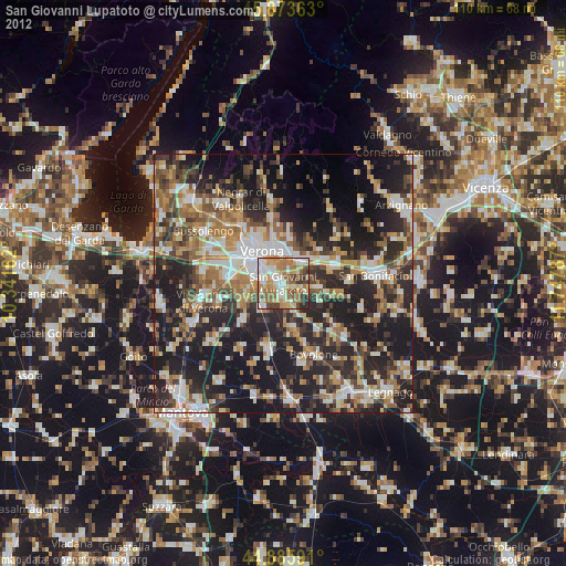
» Earth at Night: Flat Maps 2012, 2016