Gualdo Tadino night lights from space
Night Light of Gualdo Tadino (Umbria) from space (Italy) Src. Average luminocity for 10x10km area is 10.8242% and for 50x50km: 8.21%.
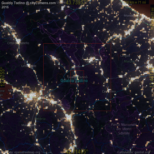
Analysis of Gualdo Tadino night lights 2016
Square area 10x10 km:
 0.76%
0.76%90-99
1.06%80-89
1.36%70-79
2.42%60-69
1.67%50-59
1.06%40-49
1.97%30-39
1.06%20-29
0.15%10-19
1.97%0-9
86.52%Square area 50x50 km:
0.56%90-99
1.43%80-89
0.76%70-79
0.98%60-69
0.73%50-59
0.85%40-49
1.6%30-39
1.07%20-29
2.19%10-19
6.68%0-9
83.16%Clear (daylight) street map image can be seen on geolist.org.
Map coordinates:
43° 44' 22.5" North, 12° 4' 31.8" East
43° 13' 45.9" North, 12° 46' 43" East
42° 42' 53.8" North, 13° 28' 54.3" East
Some cities around Gualdo Tadino sort by population:
• Foligno
31.1 km =19.3 mi,  191°
191°
• Fabriano
15.9 km =9.9 mi,  39°
39°
• Bastia umbra
26.3 km =16.3 mi,  225°
225°
• Gubbio
21.4 km =13.3 mi,  308°
308°
• Matelica
18.8 km =11.7 mi,  80°
80°
• San Severino Marche
32.5 km =20.2 mi,  89°
89°
• Santa Maria degli Angeli
25.3 km =15.7 mi,  220°
220°
• bishopric of Perugia
34.2 km =21.3 mi,  247°
247°
3175722 (p: 9,748)
Sources (retrieved 2019-11-25):
» Earth at Night: Flat Maps 2012, 2016