Foligno night lights from space
Night Light of Foligno (Umbria) from space (Italy) Src. Average luminocity for 10x10km area is 42.4889% and for 50x50km: 10.9975%.
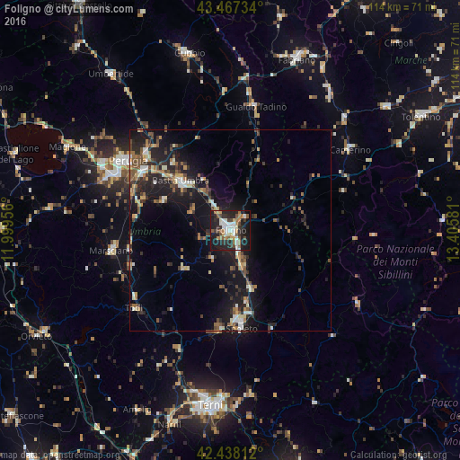
Analysis of Foligno night lights 2016
Square area 10x10 km:
 7.62%
7.62%90-99
8.25%80-89
3.17%70-79
4.13%60-69
7.46%50-59
4.76%40-49
6.35%30-39
5.4%20-29
17.78%10-19
32.38%0-9
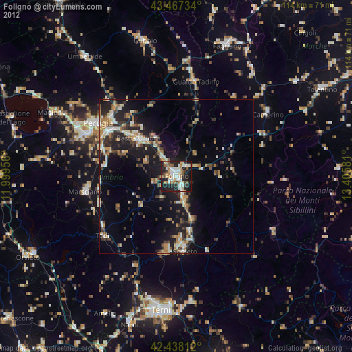
2.7%Square area 50x50 km:
0.92%90-99
1.49%80-89
0.99%70-79
1.31%60-69
1.53%50-59
1.55%40-49
2.37%30-39
1.58%20-29
4.01%10-19
10.5%0-9
73.76%Clear (daylight) street map image can be seen on geolist.org.
Map coordinates:
43° 28' 2.4" North, 11° 59' 58.4" East
42° 57' 17.6" North, 12° 42' 9.6" East
42° 26' 17.2" North, 13° 24' 20.9" East
Some cities around Foligno sort by population:
• Perugia
30.9 km =19.2 mi,  304°
304°
• Spoleto
24 km =14.9 mi,  172°
172°
• Bastia umbra
17.6 km =10.9 mi,  313°
313°
• Gualdo Tadino
31.1 km =19.3 mi,  11°
11°
• Marsciano
28.9 km =18 mi,  262°
262°
• Santa Maria degli Angeli
15.4 km =9.6 mi,  317°
317°
• Todi
30.7 km =19.1 mi,  230°
230°
• bishopric of Perugia
30.9 km =19.2 mi, 304°
3176854 (p: 47,747)
Sources (retrieved 2019-11-25):
» Earth at Night: Flat Maps 2012, 2016