Castel Bolognese night lights from space
Night Light of Castel Bolognese (Emilia-Romagna) from space (Italy) Src. Average luminocity for 10x10km area is 23.5238% and for 50x50km: 17.8859%.
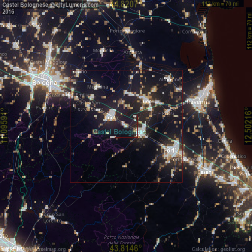
Analysis of Castel Bolognese night lights 2016
Square area 10x10 km:
 3.97%
3.97%90-99
2.54%80-89
1.9%70-79
2.06%60-69
0.32%50-59
3.17%40-49
2.7%30-39
1.43%20-29
9.05%10-19
50.16%0-9
22.7%Square area 50x50 km:
2.47%90-99
3.42%80-89
1.33%70-79
1.48%60-69
1.75%50-59
1.96%40-49
2.26%30-39
2.21%20-29
5.81%10-19
23.67%0-9
53.65%Clear (daylight) street map image can be seen on geolist.org.
Map coordinates:
44° 49' 14.5" North, 11° 5' 45.3" East
44° 19' 11.3" North, 11° 47' 56.5" East
43° 48' 52.6" North, 12° 30' 7.8" East
Some cities around Castel Bolognese sort by population:
• Imola
8.1 km =5 mi,  302°
302°
• Faenza
7.2 km =4.5 mi,  117°
117°
• Lugo
14.4 km =8.9 mi,  38°
38°
• Massa Lombarda
14.3 km =8.9 mi,  7°
7°
• Bagnacavallo
17.7 km =11 mi,  53°
53°
• Russi
19.7 km =12.2 mi,  71°
71°
• Fusignano
20.6 km =12.8 mi, 37°
• Castrocaro Terme e Terra del Sole
19.6 km =12.2 mi,  138°
138°
3179735 (p: 7,537)
Sources (retrieved 2019-11-25):
» Earth at Night: Flat Maps 2012, 2016