Lugo night lights from space
Night Light of Lugo (Emilia-Romagna) from space (Italy) Src. Average luminocity for 10x10km area is 48.2048% and for 50x50km: 19.9344%.
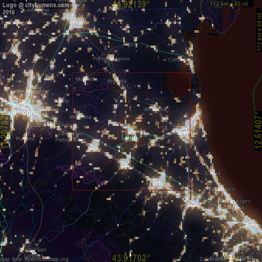
Analysis of Lugo night lights 2016
Square area 10x10 km:
 8.1%
8.1%90-99
11.27%80-89
5.24%70-79
3.65%60-69
6.51%50-59
6.35%40-49
4.92%30-39
7.3%20-29
30.79%10-19
15.87%0-9
0%Square area 50x50 km:
3.16%90-99
3.92%80-89
1.36%70-79
1.52%60-69
1.79%50-59
2.32%40-49
2.23%30-39
2.21%20-29
6.44%10-19
24.32%0-9
50.73%Clear (daylight) street map image can be seen on geolist.org.
Map coordinates:
44° 55' 17" North, 11° 12' 28.2" East
44° 25' 16.9" North, 11° 54' 39.4" East
43° 55' 1.3" North, 12° 36' 50.7" East
Some cities around Lugo sort by population:
• Imola
17.2 km =10.7 mi,  246°
246°
• Faenza
14.8 km =9.2 mi,  189°
189°
• Alfonsine
13.9 km =8.6 mi,  46°
46°
• Massa Lombarda
7.7 km =4.8 mi,  291°
291°
• Bagnacavallo
5.4 km =3.4 mi,  98°
98°
• Castel Bolognese
14.4 km =8.9 mi,  218°
218°
• Russi
10.9 km =6.8 mi,  117°
117°
• Fusignano
6.2 km =3.9 mi,  35°
35°
3174494 (p: 21,273)
Sources (retrieved 2019-11-25):
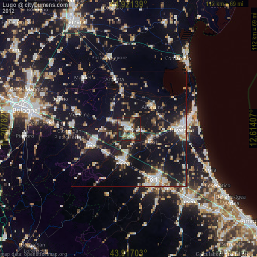
» Earth at Night: Flat Maps 2012, 2016