Camponogara night lights from space
Night Light of Camponogara (Veneto) from space (Italy) Src. Average luminocity for 10x10km area is 51.2429% and for 50x50km: 44.3998%.
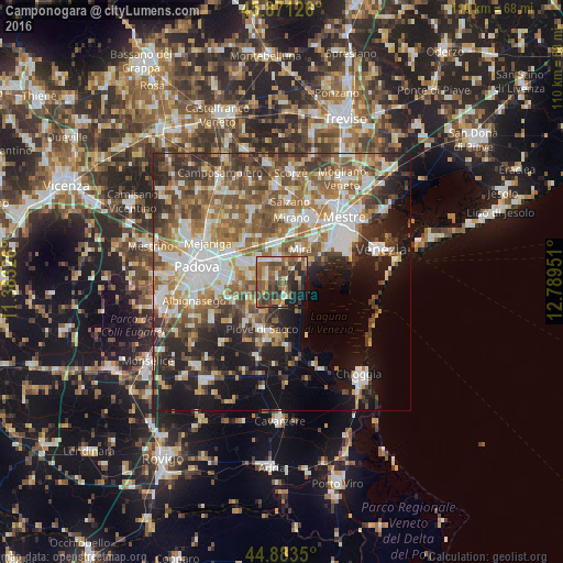
Analysis of Camponogara night lights 2016
Square area 10x10 km:
 3.17%
3.17%90-99
8.1%80-89
5.71%70-79
5.56%60-69
11.75%50-59
14.92%40-49
18.25%30-39
9.84%20-29
10.63%10-19
10%0-9
2.06%Square area 50x50 km:
8.23%90-99
9.21%80-89
4.11%70-79
5.19%60-69
7.56%50-59
8.78%40-49
8.02%30-39
6.69%20-29
8.18%10-19
12.37%0-9
21.67%Clear (daylight) street map image can be seen on geolist.org.
Map coordinates:
45° 52' 16.5" North, 11° 22' 59.7" East
45° 22' 46.3" North, 12° 5' 11" East
44° 53' 0.6" North, 12° 47' 22.2" East
Some cities around Camponogara sort by population:
• Mira Taglio
7 km =4.3 mi,  28°
28°
• Dolo
5.1 km =3.2 mi,  358°
358°
• Fiesso
6.1 km =3.8 mi,  317°
317°
• Stra
6.6 km =4.1 mi,  302°
302°
• Villatora
9.3 km =5.8 mi,  275°
275°
• Sant'Angelo di Piove di Sacco
9.2 km =5.7 mi,  221°
221°
• Fiesso d'Artico
6.4 km =4 mi, 316°
• Fossò
3.2 km =2 mi, 282°
3180937 (p: 10,817)
Sources (retrieved 2019-11-25):
» Earth at Night: Flat Maps 2012, 2016