Mira Taglio night lights from space
Night Light of Mira Taglio (Veneto) from space (Italy) Src. Average luminocity for 10x10km area is 64.8889% and for 50x50km: 45.6153%.
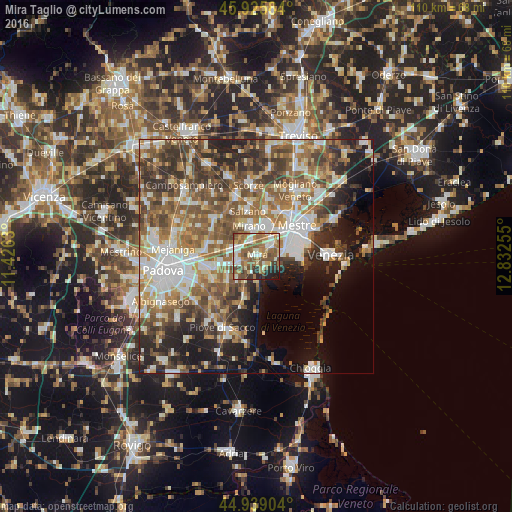
Analysis of Mira Taglio night lights 2016
Square area 10x10 km:
 9.52%
9.52%90-99
13.02%80-89
8.73%70-79
7.78%60-69
15.24%50-59
21.75%40-49
8.73%30-39
5.71%20-29
6.67%10-19
2.86%0-9
0%Square area 50x50 km:
7.95%90-99
9.28%80-89
4.31%70-79
5.45%60-69
7.95%50-59
9.71%40-49
8.98%30-39
7.62%20-29
8.36%10-19
9.92%0-9
20.48%Clear (daylight) street map image can be seen on geolist.org.
Map coordinates:
45° 55' 33" North, 11° 25' 34.7" East
45° 26' 4.6" North, 12° 7' 45.9" East
44° 56' 20.5" North, 12° 49' 57.2" East
Some cities around Mira Taglio sort by population:
• Spinea-Orgnano
6.6 km =4.1 mi,  17°
17°
• Mirano
6.9 km =4.3 mi,  345°
345°
• Camponogara
7 km =4.3 mi,  208°
208°
• Dolo
3.7 km =2.3 mi,  253°
253°
• Fiesso
7.6 km =4.7 mi,  257°
257°
• Stra
9.4 km =5.8 mi, 253°
• Fiesso d'Artico
7.9 km =4.9 mi, 259°
• Fossò
8.5 km =5.3 mi,  230°
230°
3173385 (p: 32,881)
Sources (retrieved 2019-11-25):
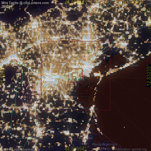
» Earth at Night: Flat Maps 2012, 2016