Arenzano night lights from space
Night Light of Arenzano (Liguria) from space (Italy) Src. Average luminocity for 10x10km area is 18.5% and for 50x50km: 11.7329%.
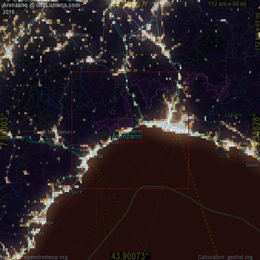
Analysis of Arenzano night lights 2016
Square area 10x10 km:
 1.59%
1.59%90-99
2.22%80-89
0.95%70-79
3.02%60-69
2.7%50-59
3.65%40-49
3.65%30-39
3.17%20-29
0.79%10-19
10.48%0-9
67.78%Square area 50x50 km:
2.35%90-99
2.5%80-89
0.63%70-79
0.91%60-69
0.94%50-59
1.48%40-49
1.42%30-39
1.86%20-29
3.49%10-19
9%0-9
75.42%Clear (daylight) street map image can be seen on geolist.org.
Map coordinates:
44° 54' 19.3" North, 7° 58' 48.1" East
44° 24' 18.8" North, 8° 40' 59.3" East
43° 54' 2.6" North, 9° 23' 10.6" East
Some cities around Arenzano sort by population:
• Genoa
20.8 km =12.9 mi,  90°
90°
• Savona
19.6 km =12.2 mi,  236°
236°
• Varazze
8.3 km =5.2 mi, 236°
• Albisola Superiore
15.6 km =9.7 mi, 241°
• Serra Riccò
23.4 km =14.5 mi,  59°
59°
• Cogoleto
3.3 km =2.1 mi, 239°
• Pedemonte
22.1 km =13.7 mi, 60°
• Albisola Marina
16.1 km =10 mi, 239°
3182887 (p: 11,226)
Sources (retrieved 2019-11-25):
» Earth at Night: Flat Maps 2012, 2016