Serra Riccò night lights from space
Night Light of Serra Riccò (Liguria) from space (Italy) Src. Average luminocity for 10x10km area is 39.0048% and for 50x50km: 13.6616%.
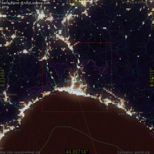
Analysis of Serra Riccò night lights 2016
Square area 10x10 km:
 4.29%
4.29%90-99
5.24%80-89
2.54%70-79
2.22%60-69
6.35%50-59
9.21%40-49
8.89%30-39
14.13%20-29
14.76%10-19
28.73%0-9
3.65%Square area 50x50 km:
2.35%90-99
2.56%80-89
0.88%70-79
1.12%60-69
1.42%50-59
1.62%40-49
1.87%30-39
2.32%20-29
3.75%10-19
12.09%0-9
70.01%Clear (daylight) street map image can be seen on geolist.org.
Map coordinates:
45° 0' 35.9" North, 8° 14' 5.8" East
44° 30' 38.6" North, 8° 56' 17" East
44° 0' 25.7" North, 9° 38' 28.3" East
Some cities around Serra Riccò sort by population:
• Genoa
11.8 km =7.3 mi,  177°
177°
• Rapallo
29.2 km =18.1 mi,  127°
127°
• Arenzano
23.4 km =14.5 mi,  239°
239°
• Recco
23.2 km =14.4 mi,  135°
135°
• Ovada
27.4 km =17 mi,  300°
300°
• Cogoleto
26.7 km =16.6 mi, 239°
• Pedemonte
1.3 km =0.8 mi,  228°
228°
• Busalla
6.7 km =4.2 mi,  5°
5°
3166656 (p: 7,879)
Sources (retrieved 2019-11-25):
» Earth at Night: Flat Maps 2012, 2016