Savona night lights from space
Night Light of Savona (Liguria) from space (Italy) Src. Average luminocity for 10x10km area is 42.5136% and for 50x50km: 8.6118%.
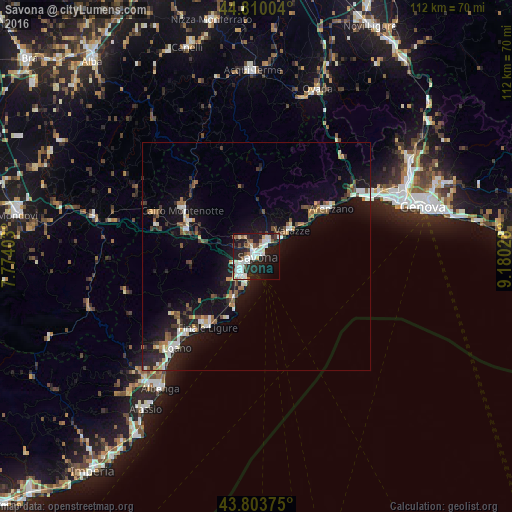
Analysis of Savona night lights 2016
Square area 10x10 km:
 10.76%
90-99
13.18%80-89
2.42%70-79
1.52%60-69
1.97%50-59
5.45%40-49
3.33%30-39
3.48%20-29
18.18%10-19
28.33%0-9
11.36%Square area 50x50 km:
1.1%90-99
1.69%80-89
0.48%70-79
0.66%60-69
0.9%50-59
1.15%40-49
1.13%30-39
1.14%20-29
2.31%10-19
8.97%0-9
80.46%Clear (daylight) street map image can be seen on geolist.org.
Map coordinates:
44° 48' 36.1" North, 7° 46' 26.5" East
44° 18' 32.6" North, 8° 28' 37.7" East
43° 48' 13.5" North, 9° 10' 49" East
Some cities around Savona sort by population:
• Varazze
11.3 km =7 mi,  57°
57°
• Albisola Superiore
4.2 km =2.6 mi,  38°
38°
• Cairo Montenotte
18.7 km =11.6 mi,  301°
301°
• Vado Ligure
5.6 km =3.5 mi,  217°
217°
• Cogoleto
16.2 km =10.1 mi, 56°
• Carcare
15.7 km =9.8 mi,  288°
288°
• Albisola Marina
3.5 km =2.2 mi,  46°
46°
• Vado Centro
5.7 km =3.5 mi, 218°
3167022 (p: 58,283)
Sources (retrieved 2019-11-25):
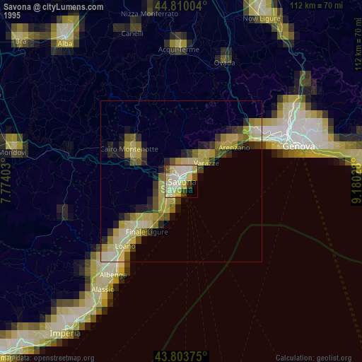
» NASA, Earths city lights 1995
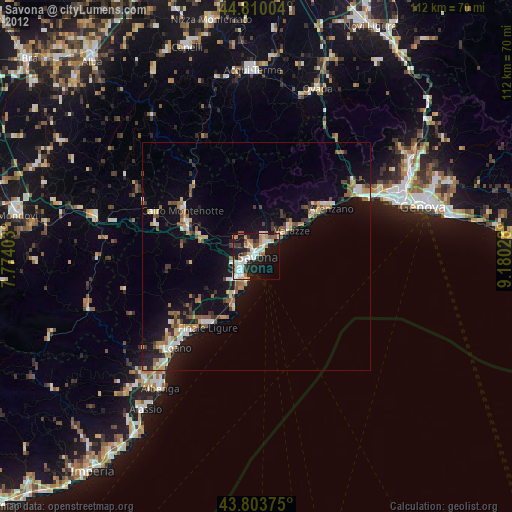
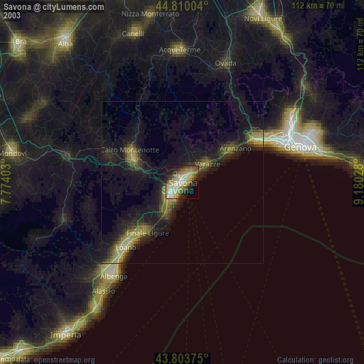
» NASA city lights 2003
» Earth at Night: Flat Maps 2012, 2016