Alessano night lights from space
Night Light of Alessano (Apulia) from space (Italy) Src. Average luminocity for 10x10km area is 43.6054% and for 50x50km: 16.0115%.
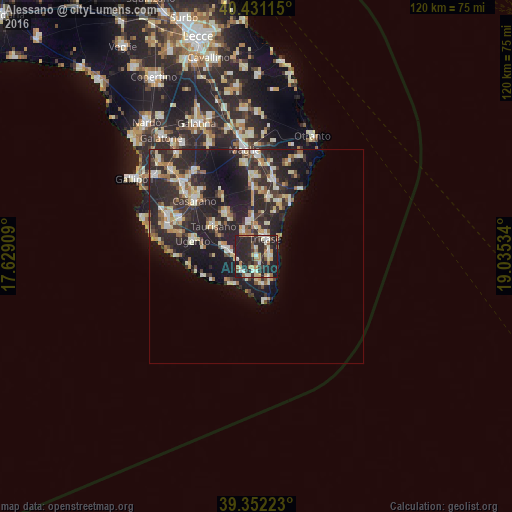
Analysis of Alessano night lights 2016
Square area 10x10 km:
 3.06%
3.06%90-99
10.37%80-89
5.1%70-79
6.12%60-69
7.31%50-59
2.72%40-49
3.4%30-39
7.65%20-29
38.95%10-19
15.31%0-9
0%Square area 50x50 km:
1.3%90-99
3.03%80-89
2.25%70-79
1.69%60-69
2.18%50-59
1.27%40-49
1.41%30-39
3.64%20-29
10.4%10-19
11.86%0-9
60.97%Clear (daylight) street map image can be seen on geolist.org.
Map coordinates:
40° 25' 52.1" North, 17° 37' 44.7" East
39° 53' 37.7" North, 18° 19' 56" East
39° 21' 8" North, 19° 2' 7.2" East
Some cities around Alessano sort by population:
• Tricase
4.5 km =2.8 mi,  24°
24°
• Taurisano
12.2 km =7.6 mi,  305°
305°
• Ruffano
12.1 km =7.5 mi,  324°
324°
• Ugento
15.3 km =9.5 mi,  284°
284°
• Poggiardo
18.1 km =11.2 mi,  12°
12°
• Corsano
3.1 km =1.9 mi,  99°
99°
• Presicce
6 km =3.7 mi, 277°
• Gagliano del Capo
6.5 km =4 mi,  150°
150°
2525748 (p: 5,078)
Sources (retrieved 2019-11-25):
» Earth at Night: Flat Maps 2012, 2016