Poggiardo night lights from space
Night Light of Poggiardo (Apulia) from space (Italy) Src. Average luminocity for 10x10km area is 49.9935% and for 50x50km: 21.635%.
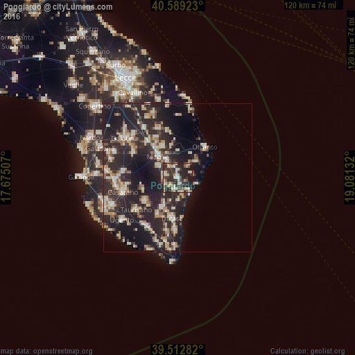
Analysis of Poggiardo night lights 2016
Square area 10x10 km:
 3.73%
3.73%90-99
12.66%80-89
9.74%70-79
5.03%60-69
4.38%50-59
6.82%40-49
3.08%30-39
17.69%20-29
27.44%10-19
9.42%0-9
0%Square area 50x50 km:
1.83%90-99
4.18%80-89
2.9%70-79
2.4%60-69
2.56%50-59
1.7%40-49
2.14%30-39
4.91%20-29
14.21%10-19
16.35%0-9
46.82%Clear (daylight) street map image can be seen on geolist.org.
Map coordinates:
40° 35' 21.2" North, 17° 40' 30.3" East
40° 3' 11.3" North, 18° 22' 41.5" East
39° 30' 46.2" North, 19° 4' 52.8" East
Some cities around Poggiardo sort by population:
• Maglie
10.1 km =6.3 mi,  317°
317°
• Tricase
13.8 km =8.6 mi,  188°
188°
• Taurisano
17.5 km =10.9 mi,  232°
232°
• Martano
17.8 km =11.1 mi,  338°
338°
• Ruffano
13.5 km =8.4 mi, 234°
• Cutrofiano
17 km =10.6 mi,  298°
298°
• Scorrano
7.8 km =4.8 mi, 301°
• Corigliano d'Otranto
15.7 km =9.8 mi, 318°
3170505 (p: 5,863)
Sources (retrieved 2019-11-25):
» Earth at Night: Flat Maps 2012, 2016