Taurisano night lights from space
Night Light of Taurisano (Apulia) from space (Italy) Src. Average luminocity for 10x10km area is 35.9677% and for 50x50km: 22.629%.
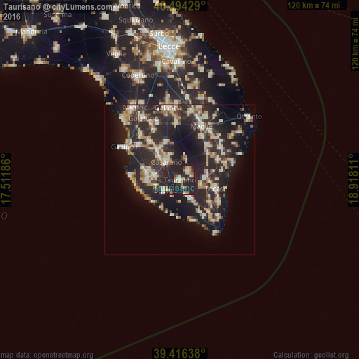
Analysis of Taurisano night lights 2016
Square area 10x10 km:
 1.7%
1.7%90-99
6.63%80-89
3.74%70-79
5.61%60-69
5.44%50-59
2.04%40-49
2.38%30-39
5.27%20-29
34.69%10-19
32.48%0-9
0%Square area 50x50 km:
2.07%90-99
4.32%80-89
3.01%70-79
2.49%60-69
2.95%50-59
1.98%40-49
2.2%30-39
5.03%20-29
14.02%10-19
15.48%0-9
46.46%Clear (daylight) street map image can be seen on geolist.org.
Map coordinates:
40° 29' 39.4" North, 17° 30' 42.7" East
39° 57' 26.9" North, 18° 12' 53.9" East
39° 24' 59" North, 18° 55' 5.2" East
Some cities around Taurisano sort by population:
• Casarano
7.5 km =4.7 mi,  323°
323°
• Taviano
11.7 km =7.3 mi,  283°
283°
• Matino
10.6 km =6.6 mi, 320°
• Racale
10.5 km =6.5 mi,  272°
272°
• Ruffano
4 km =2.5 mi,  47°
47°
• Ugento
5.9 km =3.7 mi,  235°
235°
• Melissano
8.2 km =5.1 mi, 282°
• Presicce
7.5 km =4.7 mi,  147°
147°
2522970 (p: 10,799)
Sources (retrieved 2019-11-25):
» Earth at Night: Flat Maps 2012, 2016