Neyshābūr night lights from space
Night Light of Neyshābūr (Razavi Khorasan) from space (Iran) Src. Average luminocity for 10x10km area is 70.2098% and for 50x50km: 8.3729%.
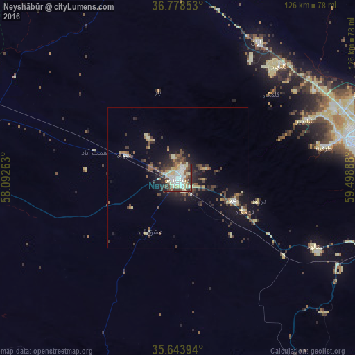
Analysis of Neyshābūr night lights 2016
Square area 10x10 km:
 14.51%
90-99
20.63%80-89
19.93%70-79
2.1%60-69
5.94%50-59
4.37%40-49
12.06%30-39
10.66%20-29
8.92%10-19
0.87%0-9
0%Square area 50x50 km:
0.65%90-99
1.28%80-89
1.64%70-79
0.48%60-69
0.75%50-59
0.9%40-49
1.92%30-39
2.02%20-29
2.23%10-19
5.74%0-9
82.39%Clear (daylight) street map image can be seen on geolist.org.
Map coordinates:
36° 46' 42.7" North, 58° 5' 33.5" East
36° 12' 47.8" North, 58° 47' 44.7" East
35° 38' 38.2" North, 59° 29' 56" East
Some cities around Neyshābūr sort by population:
• Mashhad
70.2 km =43.6 mi,  80°
80°
• Sabzevar
99.9 km =62.1 mi,  269°
269°
• Torbat-e Ḩeydarīyeh
111.2 km =69.1 mi,  159°
159°
• Qūchān
102.5 km =63.7 mi,  345°
345°
• Kāshmar
112.4 km =69.8 mi,  195°
195°
• Chenārān
56.2 km =34.9 mi,  31°
31°
• Bardaskan
129.3 km =80.3 mi,  215°
215°
• Kaka, TM
145.7 km =90.5 mi, 30°
122285 (p: 220,929)
Sources (retrieved 2019-11-25):
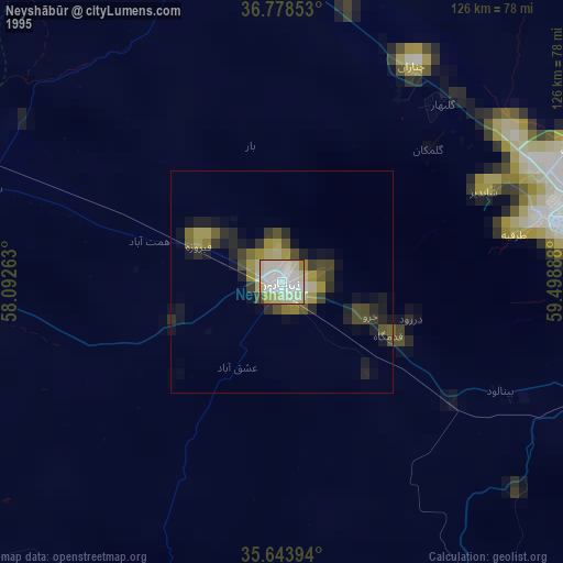
» NASA, Earths city lights 1995
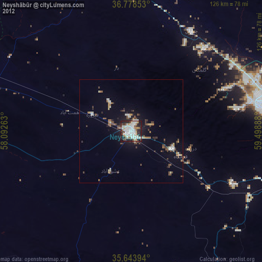
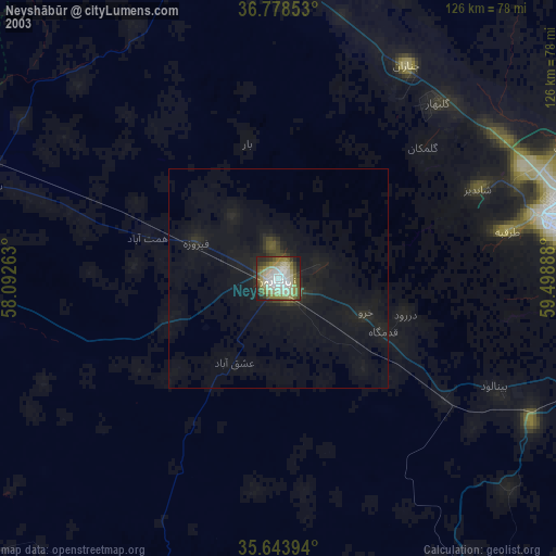
» NASA city lights 2003
» Earth at Night: Flat Maps 2012, 2016