Bābolsar night lights from space
Night Light of Bābolsar (Māzandarān) from space (Iran) Src. Average luminocity for 10x10km area is 58.8755% and for 50x50km: 26.0949%.
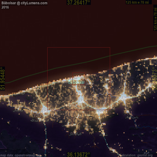
Analysis of Bābolsar night lights 2016
Square area 10x10 km:
 12.27%
90-99
13.19%80-89
4.4%70-79
11.17%60-69
10.07%50-59
6.59%40-49
7.14%30-39
7.88%20-29
16.48%10-19
10.81%0-9
0%Square area 50x50 km:
2.32%90-99
2.83%80-89
1.46%70-79
4.11%60-69
6.2%50-59
4.29%40-49
7.68%30-39
7.65%20-29
9.28%10-19
12.17%0-9
42%Clear (daylight) street map image can be seen on geolist.org.
Map coordinates:
37° 15' 51" North, 51° 57' 16.1" East
36° 42' 9" North, 52° 39' 27.4" East
36° 8' 12.2" North, 53° 21' 38.6" East
Some cities around Bābolsar sort by population:
• Sari
39.1 km =24.3 mi,  113°
113°
• Āmol
37.7 km =23.4 mi,  226°
226°
• Behshahr
79.8 km =49.6 mi,  90°
90°
• Chālūs
110.5 km =68.7 mi,  267°
267°
• Nekā
57.5 km =35.7 mi,  95°
95°
• Nowshahr
103.7 km =64.4 mi, 266°
• Fereydūnkenār
12.2 km =7.6 mi,  261°
261°
• Jūybār
23.7 km =14.7 mi, 106°
142358 (p: 48,051)
Sources (retrieved 2019-11-25):
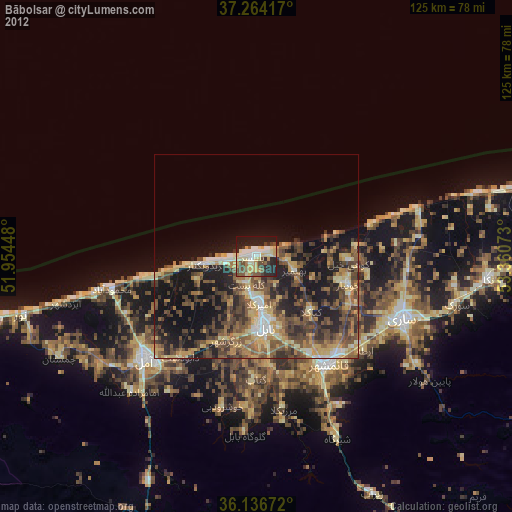
» Earth at Night: Flat Maps 2012, 2016