Sīnah night lights from space
Night Light of Sīnah (Dahūk) from space (Iraq) Src. Average luminocity for 10x10km area is 34.9808% and for 50x50km: 15.8781%.
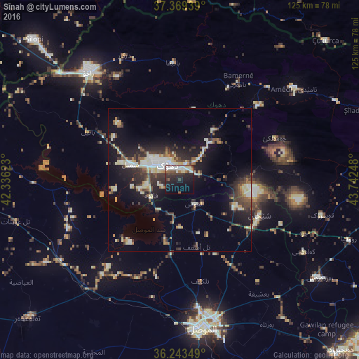
Analysis of Sīnah night lights 2016
Square area 10x10 km:
 9.27%
9.27%90-99
7.34%80-89
3.67%70-79
0.7%60-69
2.1%50-59
2.97%40-49
4.55%30-39
6.12%20-29
12.59%10-19
24.3%0-9
26.4%Square area 50x50 km:
1.61%90-99
3.37%80-89
2.15%70-79
1.18%60-69
1.28%50-59
1.65%40-49
2.75%30-39
3.39%20-29
4.89%10-19
11.31%0-9
66.43%Clear (daylight) street map image can be seen on geolist.org.
Map coordinates:
37° 22' 9.8" North, 42° 20' 10.4" East
36° 48' 30.6" North, 43° 2' 21.7" East
36° 14' 36.6" North, 43° 44' 32.9" East
Some cities around Sīnah sort by population:
• Al Mawşil al Jadīdah
53.2 km =33.1 mi,  173°
173°
• Mosul
53.1 km =33 mi, 172°
• Dihok
7.9 km =4.9 mi,  325°
325°
• Zaxo
49.2 km =30.6 mi,  320°
320°
• Silopi, TR
70.4 km =43.7 mi,  313°
313°
• Al-Hamdaniya
67 km =41.6 mi,  153°
153°
• Batifa
40.8 km =25.4 mi,  356°
356°
• Tallkayf
36 km =22.4 mi, 168°
90708 (p: 128,776)
Sources (retrieved 2019-11-25):
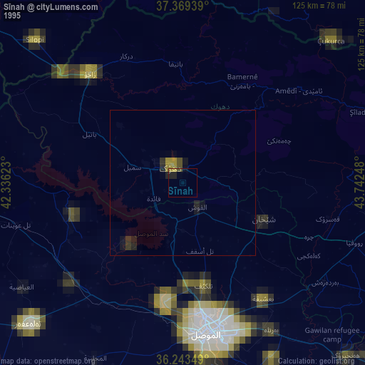
» NASA, Earths city lights 1995
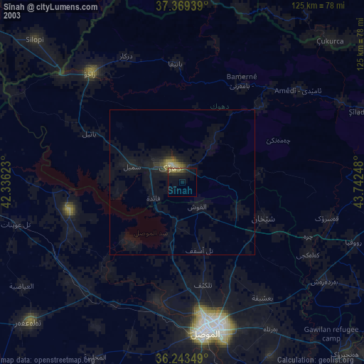
» NASA city lights 2003
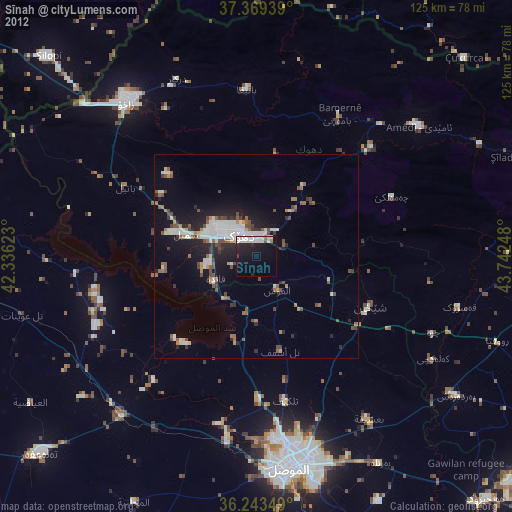
» Earth at Night: Flat Maps 2012, 2016