Ramadi night lights from space
Night Light of Ramadi (Al Anbar) from space (Iraq) Src. Average luminocity for 10x10km area is 44.4983% and for 50x50km: 3.9823%.
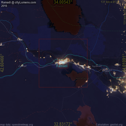
Analysis of Ramadi night lights 2016
Square area 10x10 km:
 1.22%
1.22%90-99
20.98%80-89
5.42%70-79
2.1%60-69
5.42%50-59
4.2%40-49
6.29%30-39
3.67%20-29
9.97%10-19
30.07%0-9
10.66%Square area 50x50 km:
0.05%90-99
1.1%80-89
0.36%70-79
0.36%60-69
0.41%50-59
0.54%40-49
0.6%30-39
0.78%20-29
0.76%10-19
3.44%0-9
91.6%Clear (daylight) street map image can be seen on geolist.org.
Map coordinates:
34° 0' 19.5" North, 42° 36' 16.8" East
33° 25' 14" North, 43° 18' 28" East
32° 49' 54.2" North, 44° 0' 39.3" East
Some cities around Ramadi sort by population:
• Baghdad
101.9 km =63.3 mi,  95°
95°
• Abū Ghurayb
82.4 km =51.2 mi, 98°
• Karbala
111.7 km =69.4 mi,  143°
143°
• Al Fallūjah
45.1 km =28 mi, 100°
• Sāmarrā’
101.4 km =63 mi,  31°
31°
• Balad
101.8 km =63.3 mi,  49°
49°
• Hīt
50.6 km =31.4 mi,  298°
298°
• Ad Dujayl
98 km =60.9 mi,  61°
61°
98717 (p: 274,539)
Sources (retrieved 2019-11-25):
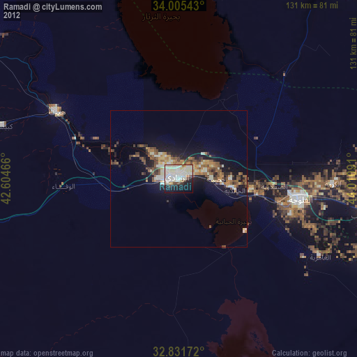
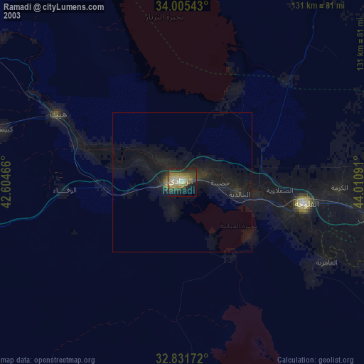
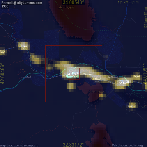
» NASA, Earths city lights 1995
» NASA city lights 2003
» Earth at Night: Flat Maps 2012, 2016