Al Fallūjah night lights from space
Night Light of Al Fallūjah (Al Anbar) from space (Iraq) Src. Average luminocity for 10x10km area is 3.2535% and for 50x50km: 8.988%.
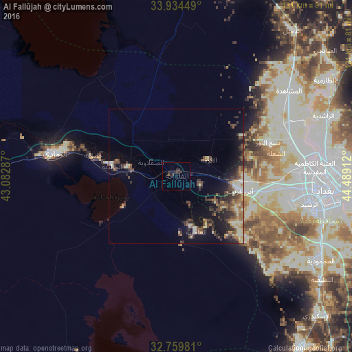
Analysis of Al Fallūjah night lights 2016
Square area 10x10 km:
 0%
0%90-99
0%80-89
0%70-79
0%60-69
0%50-59
0%40-49
1.4%30-39
3.32%20-29
2.45%10-19
3.15%0-9
89.69%Square area 50x50 km:
0.21%90-99
2%80-89
0.9%70-79
0.83%60-69
1.23%50-59
1.4%40-49
2.17%30-39
2.26%20-29
2.85%10-19
5.74%0-9
80.41%Clear (daylight) street map image can be seen on geolist.org.
Map coordinates:
33° 56' 4.2" North, 43° 4' 58.3" East
33° 20' 56.9" North, 43° 47' 9.6" East
32° 45' 35.3" North, 44° 29' 20.8" East
Some cities around Al Fallūjah sort by population:
• Baghdad
57.1 km =35.5 mi,  90°
90°
• Abū Ghurayb
37.4 km =23.2 mi,  97°
97°
• Karbala
84.5 km =52.5 mi,  164°
164°
• Ramadi
45.1 km =28 mi,  280°
280°
• Al Musayyib
78.9 km =49 mi,  143°
143°
• Balad
81.2 km =50.5 mi,  24°
24°
• Nāḩīyat Saddat al Hindīyah
84.1 km =52.3 mi,  146°
146°
• Ad Dujayl
69.2 km =43 mi,  36°
36°
99454 (p: 190,159)
Sources (retrieved 2019-11-25):
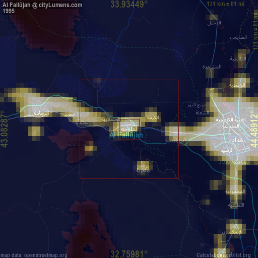
» NASA, Earths city lights 1995
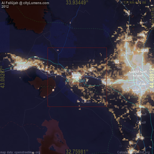
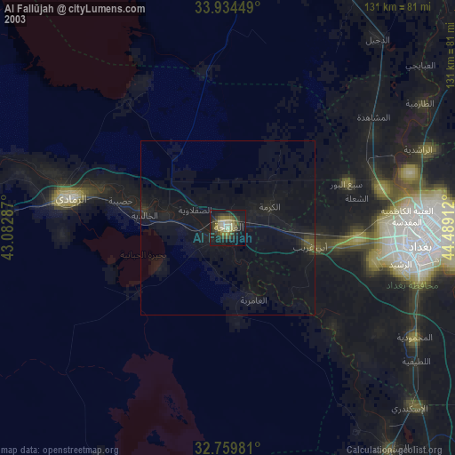
» NASA city lights 2003
» Earth at Night: Flat Maps 2012, 2016