Karbala night lights from space
Night Light of Karbala (Karbalāʼ) from space (Iraq) Src. Average luminocity for 10x10km area is 95.1364% and for 50x50km: 28.4165%.
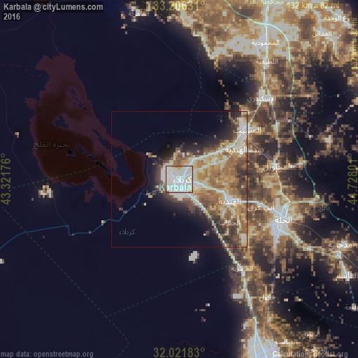
Analysis of Karbala night lights 2016
Square area 10x10 km:
 37.41%
90-99
51.92%80-89
4.2%70-79
2.27%60-69
2.27%50-59
1.22%40-49
0.7%30-39
0%20-29
0%10-19
0%0-9
0%Square area 50x50 km:
2.53%90-99
8.41%80-89
4.46%70-79
3.59%60-69
5.01%50-59
4.85%40-49
4.36%30-39
3.8%20-29
4.35%10-19
5.79%0-9
52.84%Clear (daylight) street map image can be seen on geolist.org.
Map coordinates:
33° 12' 22.7" North, 43° 19' 18.3" East
32° 36' 57.7" North, 44° 1' 29.6" East
32° 1' 18.6" North, 44° 43' 40.8" East
Some cities around Karbala sort by population:
• Abū Ghurayb
78.1 km =48.5 mi,  11°
11°
• Najaf
72.2 km =44.9 mi,  155°
155°
• Al Ḩillah
40.7 km =25.3 mi,  114°
114°
• Kufa
73.9 km =45.9 mi,  148°
148°
• Al Hindīyah
20.5 km =12.7 mi, 112°
• Al Musayyib
30.7 km =19.1 mi,  53°
53°
• Imam Qasim
71.1 km =44.2 mi,  119°
119°
• Nāḩīyat Saddat al Hindīyah
26.2 km =16.3 mi,  65°
65°
94824 (p: 434,450)
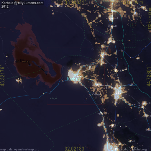
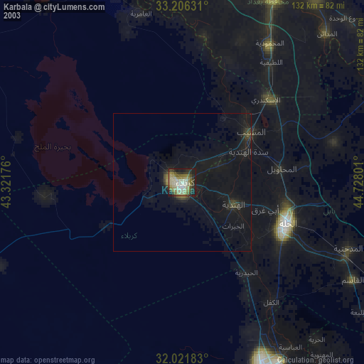
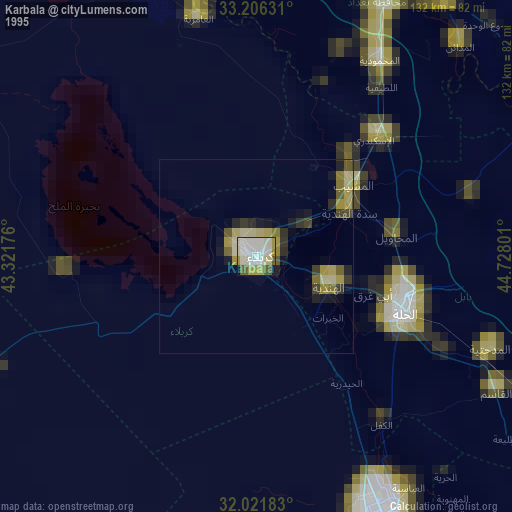
Sources (retrieved 2019-11-25):
» NASA, Earths city lights 1995
» NASA city lights 2003
» Earth at Night: Flat Maps 2012, 2016