Baqubah night lights from space
Night Light of Baqubah (Diyālá) from space (Iraq) Src. Average luminocity for 10x10km area is 81.9139% and for 50x50km: 33.1421%.
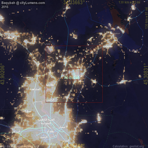
Analysis of Baqubah night lights 2016
Square area 10x10 km:
 19.41%
90-99
41.76%80-89
5.68%70-79
3.3%60-69
8.24%50-59
8.79%40-49
9.89%30-39
2.75%20-29
0.18%10-19
0%0-9
0%Square area 50x50 km:
2.25%90-99
9.05%80-89
3.31%70-79
3.74%60-69
3.94%50-59
5.44%40-49
7.29%30-39
7.22%20-29
9.62%10-19
16.07%0-9
32.06%Clear (daylight) street map image can be seen on geolist.org.
Map coordinates:
34° 20' 11.9" North, 43° 54' 7.4" East
33° 45' 14.5" North, 44° 36' 18.6" East
33° 10' 2.8" North, 45° 18' 29.9" East
Some cities around Baqubah sort by population:
• Baghdad
49.7 km =30.9 mi,  202°
202°
• Abū Ghurayb
63.3 km =39.3 mi,  218°
218°
• Sāmarrā’
82.6 km =51.3 mi,  306°
306°
• Khāliş
8.9 km =5.5 mi, 312°
• Al Miqdādīyah
39.5 km =24.5 mi,  50°
50°
• Balad
51.4 km =31.9 mi,  304°
304°
• Mandalī
87.8 km =54.6 mi,  90°
90°
• Ad Dujayl
35.8 km =22.2 mi,  286°
286°
97990 (p: 152,550)
Sources (retrieved 2019-11-25):
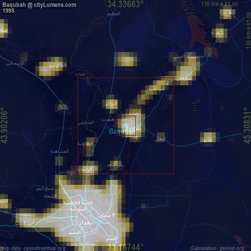
» NASA, Earths city lights 1995
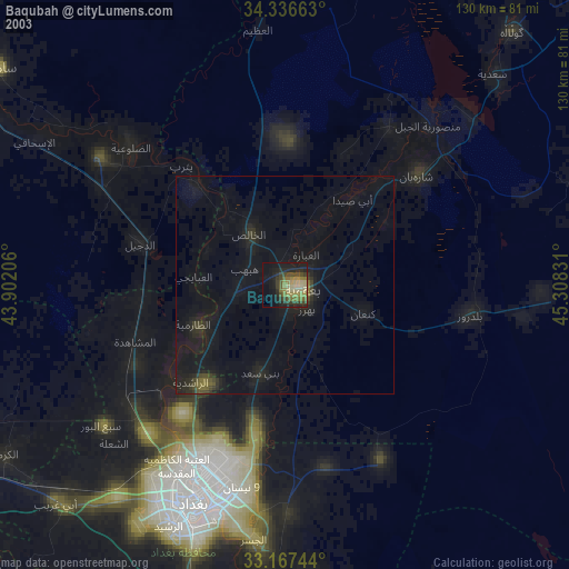
» NASA city lights 2003
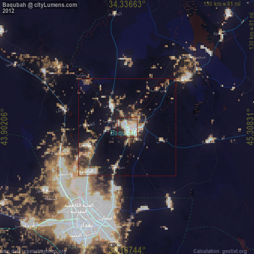
» Earth at Night: Flat Maps 2012, 2016