Nahiyat Ghammas night lights from space
Night Light of Nahiyat Ghammas (Al Qādisīyah) from space (Iraq) Src. Average luminocity for 10x10km area is 24.5128% and for 50x50km: 12.8592%.
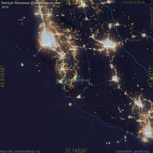
Analysis of Nahiyat Ghammas night lights 2016
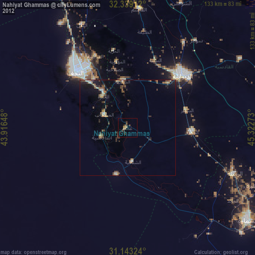
Square area 10x10 km:
 0.55%
0.55%90-99
2.38%80-89
0%70-79
2.93%60-69
5.68%50-59
7.51%40-49
7.14%30-39
4.4%20-29
5.49%10-19
29.49%0-9
34.43%Square area 50x50 km:
0.58%90-99
1.32%80-89
0.96%70-79
1.32%60-69
1.75%50-59
2.65%40-49
3.91%30-39
4.03%20-29
5.78%10-19
9.59%0-9
68.11%Clear (daylight) street map image can be seen on geolist.org.
Map coordinates:
32° 20' 20.8" North, 43° 54' 59.3" East
31° 44' 35.2" North, 44° 37' 10.6" East
31° 8' 35.7" North, 45° 19' 21.8" East
Some cities around Nahiyat Ghammas sort by population:
• Najaf
40.7 km =25.3 mi,  320°
320°
• Ad Dīwānīyah
40.1 km =24.9 mi,  46°
46°
• Kufa
38.2 km =23.7 mi,  333°
333°
• Ash Shāmīyah
24.5 km =15.2 mi,  355°
355°
• Ar Rumaythah
60.2 km =37.4 mi,  113°
113°
• Imam Qasim
62 km =38.5 mi,  5°
5°
• Al Mishkhāb
14.1 km =8.8 mi,  298°
298°
• ‘Afak
69.2 km =43 mi,  58°
58°
99434 (p: 30,909)
Sources (retrieved 2019-11-25):
» Earth at Night: Flat Maps 2012, 2016