Yeola night lights from space
Night Light of Yeola (Maharashtra) from space (India) Src. Average luminocity for 10x10km area is 26.6508% and for 50x50km: 10.9986%.
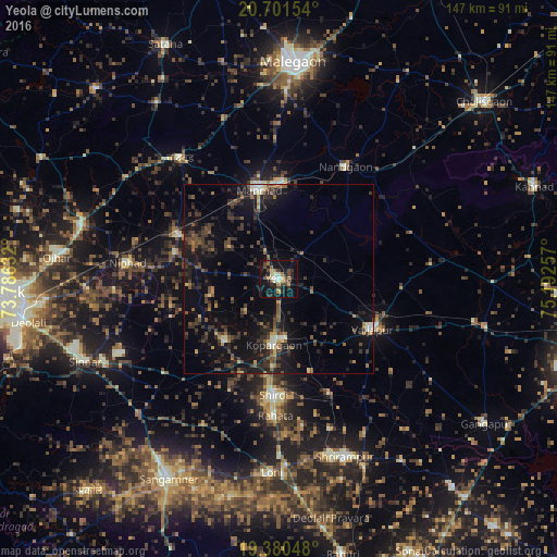
Analysis of Yeola night lights 2016
Square area 10x10 km:
 0.79%
0.79%90-99
4.76%80-89
2.38%70-79
2.98%60-69
4.37%50-59
2.98%40-49
7.34%30-39
3.77%20-29
9.33%10-19
30.16%0-9
31.15%Square area 50x50 km:
0.15%90-99
1.17%80-89
0.64%70-79
0.62%60-69
1.32%50-59
2.02%40-49
2.72%30-39
3.06%20-29
5.31%10-19
10.78%0-9
72.21%Clear (daylight) street map image can be seen on geolist.org.
Map coordinates:
20° 42' 5.5" North, 73° 47' 10.8" East
20° 2' 32.6" North, 74° 29' 22" East
19° 22' 49.7" North, 75° 11' 33.3" East
Some cities around Yeola sort by population:
• Manmād
24.1 km =15 mi,  346°
346°
• Kopargaon
17.8 km =11.1 mi,  184°
184°
• Vaijāpur
28 km =17.4 mi,  117°
117°
• Sinnar
55.8 km =34.7 mi,  246°
246°
• Shirdi
30.7 km =19.1 mi, 182°
• Nāndgaon
34.1 km =21.2 mi,  30°
30°
• Chāndor
41 km =25.5 mi,  321°
321°
• Lāsalgaon
28.4 km =17.6 mi,  293°
293°
1252738 (p: 46,762)
Sources (retrieved 2019-11-25):
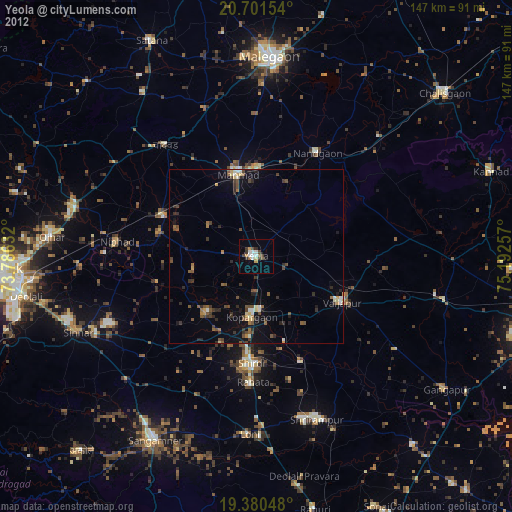
» Earth at Night: Flat Maps 2012, 2016