Vriddhāchalam night lights from space
Night Light of Vriddhāchalam (Tamil Nadu) from space (India) Src. Average luminocity for 10x10km area is 31.8506% and for 50x50km: 16.9303%.
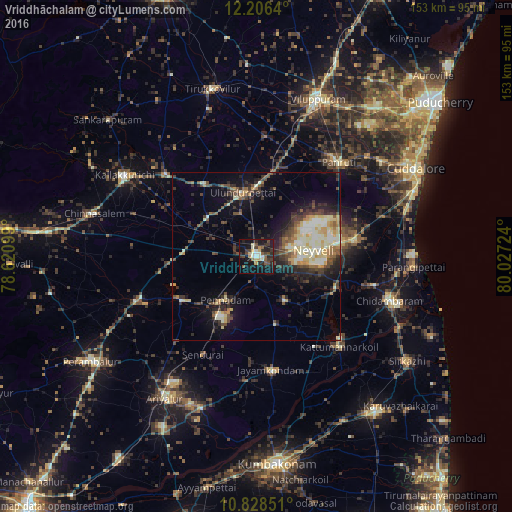
Analysis of Vriddhāchalam night lights 2016
Square area 10x10 km:
 0.87%
0.87%90-99
7.79%80-89
3.46%70-79
3.46%60-69
1.95%50-59
5.41%40-49
6.49%30-39
6.71%20-29
11.9%10-19
35.93%0-9
16.02%Square area 50x50 km:
1.07%90-99
3.64%80-89
2.76%70-79
1.72%60-69
1.37%50-59
2.22%40-49
3.27%30-39
3.37%20-29
5.55%10-19
8.73%0-9
66.31%Clear (daylight) street map image can be seen on geolist.org.
Map coordinates:
12° 12' 23" North, 78° 37' 15.6" East
11° 31' 5.9" North, 79° 19' 26.8" East
10° 49' 42.6" North, 80° 1' 38.1" East
Some cities around Vriddhāchalam sort by population:
• Chidambaram
42.2 km =26.2 mi,  108°
108°
• Panruti
38 km =23.6 mi,  40°
40°
• Jayamkondacholapuram
34.3 km =21.3 mi,  172°
172°
• Kurinjippādi
29.3 km =18.2 mi,  83°
83°
• Kīl Bhuvanagiri
36.3 km =22.6 mi,  103°
103°
• Pennādam
15.6 km =9.7 mi,  215°
215°
• Srīmushnam
15.7 km =9.8 mi,  146°
146°
• Māttūr
25.6 km =15.9 mi,  211°
211°
1253080 (p: 61,498)
Sources (retrieved 2019-11-25):
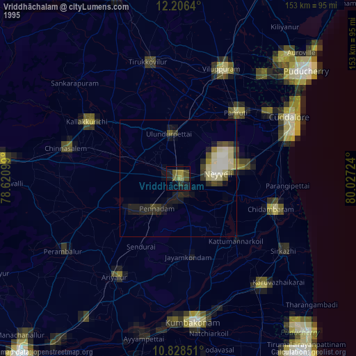
» NASA, Earths city lights 1995
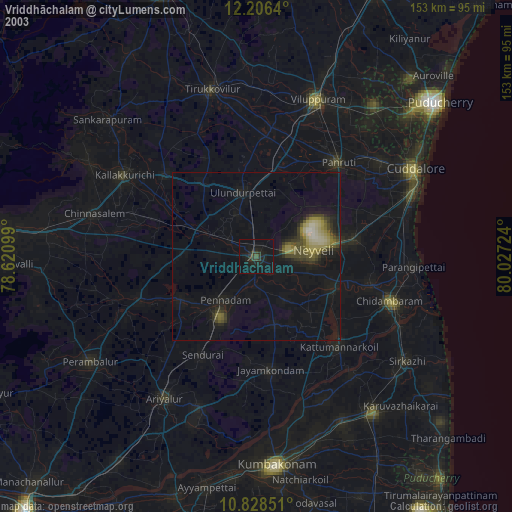
» NASA city lights 2003
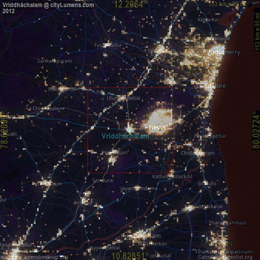
» Earth at Night: Flat Maps 2012, 2016