Jayamkondacholapuram night lights from space
Night Light of Jayamkondacholapuram (Tamil Nadu) from space (India) Src. Average luminocity for 10x10km area is 10.2879% and for 50x50km: 6.4822%.
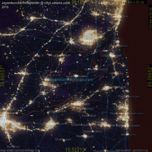
Analysis of Jayamkondacholapuram night lights 2016
Square area 10x10 km:
 0%
0%90-99
1.08%80-89
1.52%70-79
2.6%60-69
1.73%50-59
1.3%40-49
1.3%30-39
1.52%20-29
3.25%10-19
1.3%0-9
84.42%Square area 50x50 km:
0.02%90-99
0.5%80-89
0.69%70-79
0.65%60-69
0.46%50-59
0.72%40-49
1.85%30-39
1.89%20-29
3.29%10-19
5.07%0-9
84.85%Clear (daylight) street map image can be seen on geolist.org.
Map coordinates:
11° 54' 5.5" North, 78° 39' 38.1" East
11° 12' 45.6" North, 79° 21' 49.3" East
10° 31' 19.7" North, 80° 4' 0.6" East
Some cities around Jayamkondacholapuram sort by population:
• Kumbakonam
28 km =17.4 mi,  173°
173°
• Ariyalūr
32.5 km =20.2 mi,  255°
255°
• Pennādam
25.1 km =15.6 mi,  327°
327°
• Thiruvidaimaruthur
25.7 km =16 mi,  157°
157°
• Srīmushnam
21.4 km =13.3 mi,  11°
11°
• Aduthurai
25.4 km =15.8 mi,  149°
149°
• Swāmimalai
28.6 km =17.8 mi,  187°
187°
• Māttūr
21.3 km =13.2 mi,  304°
304°
1269102 (p: 32,217)
Sources (retrieved 2019-11-25):
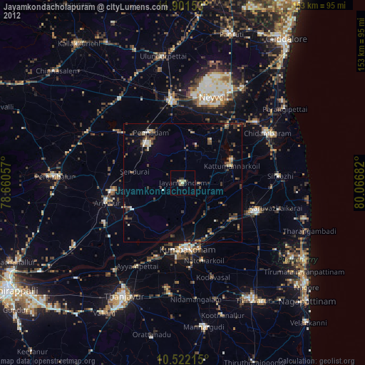
» Earth at Night: Flat Maps 2012, 2016