Ukwā night lights from space
Night Light of Ukwā (Madhya Pradesh) from space (India) Src. Average luminocity for 10x10km area is 2.6865% and for 50x50km: 1.2638%.
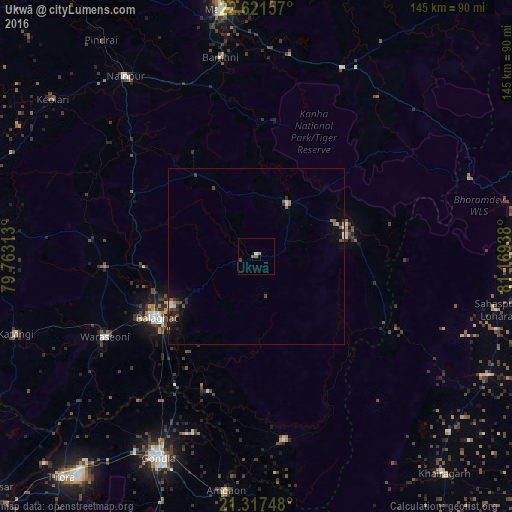
Analysis of Ukwā night lights 2016
Square area 10x10 km:
 0%
0%90-99
0.79%80-89
0%70-79
0%60-69
0.79%50-59
0.79%40-49
0.79%30-39
0.79%20-29
0%10-19
0%0-9
96.03%Square area 50x50 km:
0.12%90-99
0.12%80-89
0.05%70-79
0.06%60-69
0.21%50-59
0.29%40-49
0.27%30-39
0.23%20-29
0.42%10-19
0.73%0-9
97.49%Clear (daylight) street map image can be seen on geolist.org.
Map coordinates:
22° 37' 17.7" North, 79° 45' 47.3" East
21° 58' 15.7" North, 80° 27' 58.5" East
21° 19' 2.9" North, 81° 10' 9.8" East
Some cities around Ukwā sort by population:
• Gondiā
63.5 km =39.5 mi,  206°
206°
• Bālāghāt
33.5 km =20.8 mi,  238°
238°
• Mandlā
70.5 km =43.8 mi,  352°
352°
• Wārāseonī
49.5 km =30.8 mi, 241°
• Nainpur
63.1 km =39.2 mi,  323°
323°
• Baihar
16.8 km =10.4 mi,  30°
30°
• Katangi
71.7 km =44.6 mi,  252°
252°
• Gandai
73.7 km =45.8 mi,  117°
117°
1253898 (p: 7,369)
Sources (retrieved 2019-11-25):
» Earth at Night: Flat Maps 2012, 2016