Nainpur night lights from space
Night Light of Nainpur (Madhya Pradesh) from space (India) Src. Average luminocity for 10x10km area is 7.3788% and for 50x50km: 1.1426%.
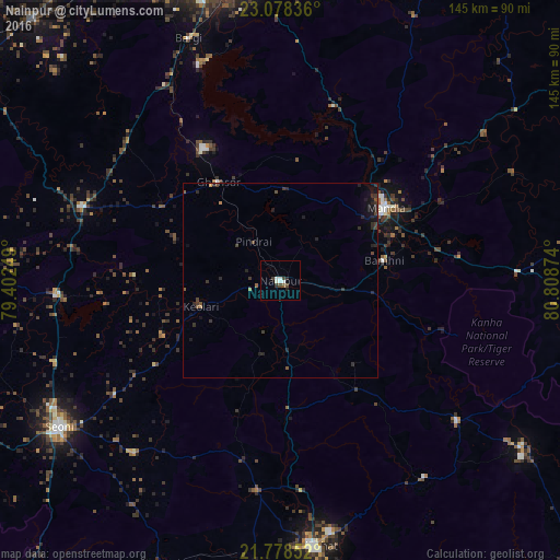
Analysis of Nainpur night lights 2016
Square area 10x10 km:
 1.7%
1.7%90-99
1.89%80-89
0.19%70-79
0%60-69
0%50-59
0.95%40-49
1.52%30-39
1.33%20-29
2.27%10-19
0.38%0-9
89.77%Square area 50x50 km:
0.07%90-99
0.08%80-89
0.01%70-79
0.05%60-69
0.09%50-59
0.18%40-49
0.28%30-39
0.4%20-29
0.75%10-19
0.73%0-9
97.37%Clear (daylight) street map image can be seen on geolist.org.
Map coordinates:
23° 4' 42.1" North, 79° 24' 9" East
22° 25' 47.9" North, 80° 6' 20.2" East
21° 46' 42.7" North, 80° 48' 31.5" East
Some cities around Nainpur sort by population:
• Bālāghāt
68.8 km =42.8 mi,  172°
172°
• Mandlā
33.1 km =20.6 mi,  55°
55°
• Bargi
66.7 km =41.4 mi,  339°
339°
• Baihar
58.5 km =36.4 mi,  128°
128°
• Lakhnādon
55.2 km =34.3 mi,  290°
290°
• Barghāt
58.7 km =36.5 mi,  220°
220°
• Ukwā
63.1 km =39.2 mi,  143°
143°
• Ghansor
30.1 km =18.7 mi,  327°
327°
1262116 (p: 22,336)
Sources (retrieved 2019-11-25):
» Earth at Night: Flat Maps 2012, 2016