Baihar night lights from space
Night Light of Baihar (Madhya Pradesh) from space (India) Src. Average luminocity for 10x10km area is 4.7341% and for 50x50km: 1.097%.
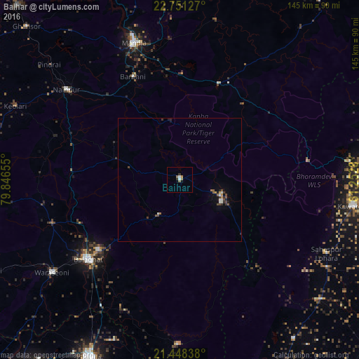
Analysis of Baihar night lights 2016
Square area 10x10 km:
 0.99%
0.99%90-99
0.6%80-89
0%70-79
0.4%60-69
1.59%50-59
1.19%40-49
0%30-39
0.79%20-29
0.79%10-19
0.6%0-9
93.06%Square area 50x50 km:
0.11%90-99
0.17%80-89
0.03%70-79
0.11%60-69
0.13%50-59
0.27%40-49
0.23%30-39
0.2%20-29
0.21%10-19
0.28%0-9
98.26%Clear (daylight) street map image can be seen on geolist.org.
Map coordinates:
22° 45' 4.6" North, 79° 50' 47.6" East
22° 6' 4.8" North, 80° 32' 58.8" East
21° 26' 54.2" North, 81° 15' 10.1" East
Some cities around Baihar sort by population:
• Bālāghāt
49 km =30.4 mi,  229°
229°
• Mandlā
58.3 km =36.2 mi,  341°
341°
• Kawardha
71 km =44.1 mi,  98°
98°
• Wārāseonī
64.5 km =40.1 mi, 234°
• Nainpur
58.5 km =36.4 mi,  308°
308°
• Gandai
74.6 km =46.4 mi,  130°
130°
• Ukwā
16.8 km =10.4 mi,  210°
210°
• Chhuīkhadān
79.2 km =49.2 mi,  144°
144°
1277776 (p: 16,168)
Sources (retrieved 2019-11-25):
» Earth at Night: Flat Maps 2012, 2016