Peddāpuram night lights from space
Night Light of Peddāpuram (Andhra Pradesh) from space (India) Src. Average luminocity for 10x10km area is 52.6234% and for 50x50km: 19.5581%.
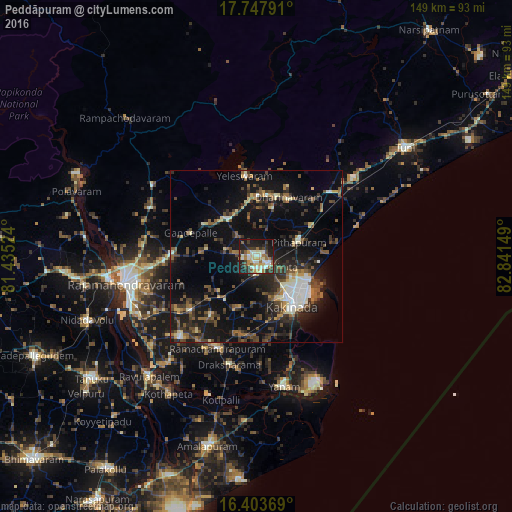
Analysis of Peddāpuram night lights 2016
Square area 10x10 km:
 2.16%
2.16%90-99
19.91%80-89
6.93%70-79
6.71%60-69
9.09%50-59
4.11%40-49
4.55%30-39
12.55%20-29
12.34%10-19
21.43%0-9
0.22%Square area 50x50 km:
1.05%90-99
3.44%80-89
1.74%70-79
1.41%60-69
2.19%50-59
3.44%40-49
3.88%30-39
4.93%20-29
6.75%10-19
17.74%0-9
53.45%Clear (daylight) street map image can be seen on geolist.org.
Map coordinates:
17° 44' 52.5" North, 81° 26' 6.9" East
17° 4' 37.2" North, 82° 8' 18.1" East
16° 24' 13.3" North, 82° 50' 29.4" East
Some cities around Peddāpuram sort by population:
• Kākināda
16.8 km =10.4 mi,  140°
140°
• Sāmalkot
4.6 km =2.9 mi,  119°
119°
• Pithāpuram
12.9 km =8 mi,  70°
70°
• Mandapeta
32.6 km =20.3 mi,  223°
223°
• Rāmachandrapuram
29.2 km =18.1 mi,  203°
203°
• Ramanayyapeta
18.1 km =11.2 mi, 144°
• Gokavaram
36.7 km =22.8 mi,  303°
303°
• vadlamuru
3.6 km =2.2 mi,  54°
54°
1259954 (p: 45,967)
Sources (retrieved 2019-11-25):
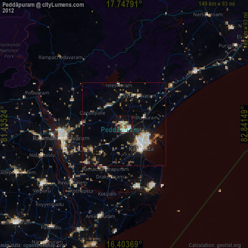
» Earth at Night: Flat Maps 2012, 2016