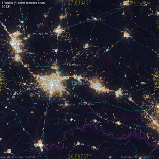
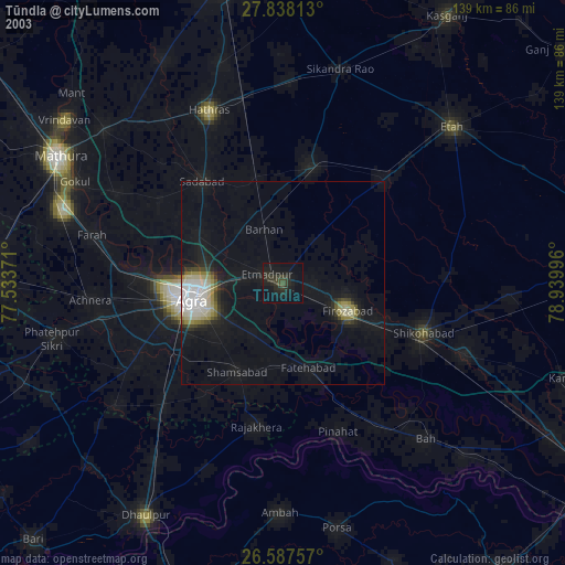
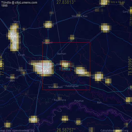
Tūndla night lights from space
Night Light of Tūndla (Uttar Pradesh) from space (India) Src. Average luminocity for 10x10km area is 33.8504% and for 50x50km: 26.2278%.
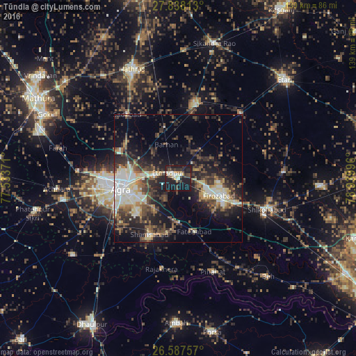
Analysis of Tūndla night lights 2016
Square area 10x10 km:
 4.55%
4.55%90-99
4.55%80-89
4.17%70-79
3.41%60-69
2.27%50-59
1.14%40-49
9.28%30-39
5.3%20-29
13.07%10-19
49.24%0-9
3.03%Square area 50x50 km:
3.52%90-99
4.3%80-89
3.67%70-79
1.88%60-69
3.08%50-59
3.61%40-49
5.55%30-39
5.75%20-29
8.95%10-19
14.95%0-9
44.73%Clear (daylight) street map image can be seen on geolist.org.
Map coordinates:
27° 50' 17.3" North, 77° 32' 1.4" East
27° 12' 52.6" North, 78° 14' 12.6" East
26° 35' 15.3" North, 78° 56' 23.9" East
Some cities around Tūndla sort by population:
• Agra
22 km =13.7 mi,  260°
260°
• Fīrozābād
17.4 km =10.8 mi,  113°
113°
• Jalesar
29.5 km =18.3 mi,  12°
12°
• Sadābād
31.7 km =19.7 mi,  321°
321°
• Shamsābād
24.6 km =15.3 mi,  207°
207°
• Itimādpur
4.5 km =2.8 mi,  301°
301°
• Fatehābād
21.9 km =13.6 mi,  162°
162°
• Pharihā
26.2 km =16.3 mi,  62°
62°
1254069 (p: 50,939)
Sources (retrieved 2019-11-25):
» NASA, Earths city lights 1995
» NASA city lights 2003
» Earth at Night: Flat Maps 2012, 2016