Shamsābād night lights from space
Night Light of Shamsābād (Uttar Pradesh) from space (India) Src. Average luminocity for 10x10km area is 33.9246% and for 50x50km: 24.1781%.
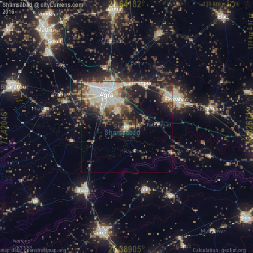
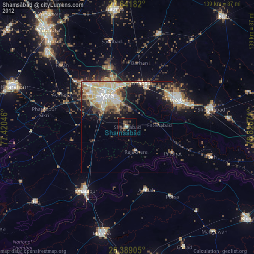
Analysis of Shamsābād night lights 2016
Square area 10x10 km:
 0.6%
0.6%90-99
2.58%80-89
4.76%70-79
2.38%60-69
6.75%50-59
6.94%40-49
10.71%30-39
8.13%20-29
17.26%10-19
33.53%0-9
6.35%Square area 50x50 km:
3.96%90-99
4.8%80-89
4.2%70-79
1.74%60-69
3.05%50-59
3.1%40-49
4.2%30-39
4.42%20-29
6.16%10-19
9.23%0-9
55.15%Clear (daylight) street map image can be seen on geolist.org.
Map coordinates:
27° 38' 30.6" North, 77° 25' 13.7" East
27° 1' 1.8" North, 78° 7' 24.9" East
26° 23' 20.6" North, 78° 49' 36.2" East
Some cities around Shamsābād sort by population:
• Agra
21.3 km =13.2 mi,  330°
330°
• Fīrozābād
31 km =19.3 mi,  61°
61°
• Tūndla
24.6 km =15.3 mi,  27°
27°
• Rājākhera
14.1 km =8.8 mi,  160°
160°
• Itimādpur
25.4 km =15.8 mi,  16°
16°
• Fatehābād
17.8 km =11.1 mi,  86°
86°
• Khairāgarh
31.3 km =19.4 mi,  254°
254°
• Pināhat
29.1 km =18.1 mi,  120°
120°
1256660 (p: 31,009)
Sources (retrieved 2019-11-25):
» Earth at Night: Flat Maps 2012, 2016