Tehri night lights from space
Night Light of Tehri (Uttarakhand) from space (India) Src. Average luminocity for 10x10km area is 29.8645% and for 50x50km: 6.1038%.
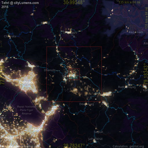
Analysis of Tehri night lights 2016
Square area 10x10 km:
 1.47%
1.47%90-99
4.95%80-89
2.38%70-79
3.48%60-69
2.56%50-59
5.31%40-49
7.51%30-39
6.59%20-29
14.47%10-19
28.94%0-9
22.34%Square area 50x50 km:
0.12%90-99
0.42%80-89
0.22%70-79
0.3%60-69
0.34%50-59
1.16%40-49
2%30-39
2.08%20-29
3.29%10-19
5.22%0-9
84.86%Clear (daylight) street map image can be seen on geolist.org.
Map coordinates:
30° 59' 43.7" North, 77° 46' 37.8" East
30° 23' 27.1" North, 78° 28' 49.1" East
29° 46' 56.9" North, 79° 11' 0.3" East
Some cities around Tehri sort by population:
• Rishīkesh
36.3 km =22.6 mi,  209°
209°
• Rāipur
38.5 km =23.9 mi,  256°
256°
• Pauri
38.9 km =24.2 mi,  132°
132°
• Mussoorie
39.9 km =24.8 mi,  280°
280°
• Srīnagar
34.6 km =21.5 mi,  122°
122°
• Uttarkāshi
37.9 km =23.5 mi,  354°
354°
• Birbhaddar
40.3 km =25 mi, 208°
• Doiwāla
42.3 km =26.3 mi,  235°
235°
1254808 (p: 27,611)
Sources (retrieved 2019-11-25):
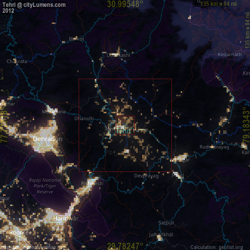
» Earth at Night: Flat Maps 2012, 2016