Mussoorie night lights from space
Night Light of Mussoorie (Uttarakhand) from space (India) Src. Average luminocity for 10x10km area is 33.4103% and for 50x50km: 17.2265%.
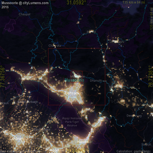
Analysis of Mussoorie night lights 2016
Square area 10x10 km:
 2.75%
2.75%90-99
7.51%80-89
3.3%70-79
2.56%60-69
3.3%50-59
4.4%40-49
3.66%30-39
6.04%20-29
24.18%10-19
29.85%0-9
12.45%Square area 50x50 km:
2.19%90-99
3.91%80-89
3.67%70-79
1.42%60-69
1.28%50-59
2.27%40-49
2.86%30-39
3.19%20-29
4.59%10-19
7.18%0-9
67.45%Clear (daylight) street map image can be seen on geolist.org.
Map coordinates:
31° 3' 33.1" North, 77° 22' 3.2" East
30° 27' 17.9" North, 78° 4' 14.4" East
29° 50' 49.2" North, 78° 46' 25.7" East
Some cities around Mussoorie sort by population:
• Dehra Dūn
14.9 km =9.3 mi,  193°
193°
• Rāipur
16.1 km =10 mi,  173°
173°
• Tehri
39.9 km =24.8 mi,  100°
100°
• Clement Town
22.1 km =13.7 mi,  195°
195°
• Vikāsnagar
28.6 km =17.8 mi,  273°
273°
• Harbatpur
31.7 km =19.7 mi, 266°
• Doiwāla
31.3 km =19.4 mi, 171°
• Barkot
41.4 km =25.7 mi,  18°
18°
1262374 (p: 25,753)
Sources (retrieved 2019-11-25):
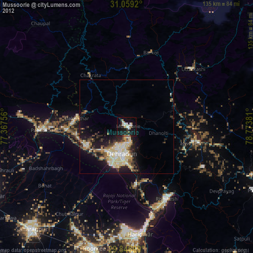
» Earth at Night: Flat Maps 2012, 2016