Sirhind night lights from space
Night Light of Sirhind (Punjab) from space (India) Src. Average luminocity for 10x10km area is 48.0664% and for 50x50km: 23.6134%.
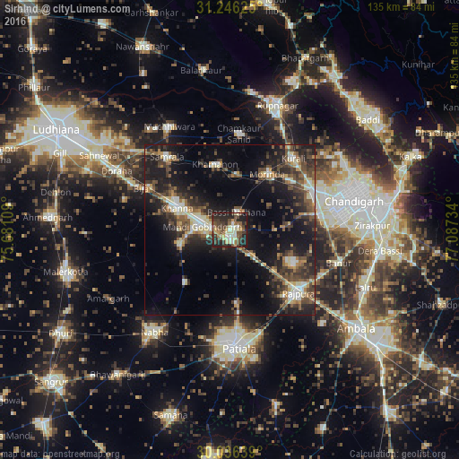
Analysis of Sirhind night lights 2016
Square area 10x10 km:
 3.15%
3.15%90-99
6.99%80-89
12.06%70-79
3.85%60-69
3.15%50-59
9.27%40-49
15.73%30-39
10.66%20-29
23.08%10-19
12.06%0-9
0%Square area 50x50 km:
1.65%90-99
3.32%80-89
2.95%70-79
2.08%60-69
2.41%50-59
4.56%40-49
5.67%30-39
5.45%20-29
9.1%10-19
17.81%0-9
45%Clear (daylight) street map image can be seen on geolist.org.
Map coordinates:
31° 14' 46.5" North, 75° 40' 51.9" East
30° 38' 35.6" North, 76° 23' 3.2" East
30° 2' 11" North, 77° 5' 14.4" East
Some cities around Sirhind sort by population:
• Khanna
17 km =10.6 mi,  294°
294°
• Rājpura
27.1 km =16.8 mi,  132°
132°
• Kharar
27.6 km =17.1 mi,  65°
65°
• Morinda
19.7 km =12.2 mi,  33°
33°
• Samrāla
28.2 km =17.5 mi,  319°
319°
• Basi
5.3 km =3.3 mi,  17°
17°
• Amloh
15.1 km =9.4 mi,  255°
255°
• Khamānon Kalān
19.6 km =12.2 mi,  351°
351°
1256087 (p: 60,847)
Sources (retrieved 2019-11-25):
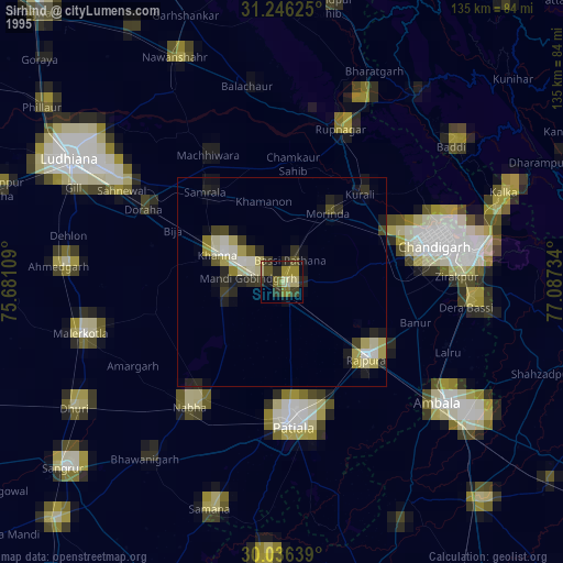
» NASA, Earths city lights 1995
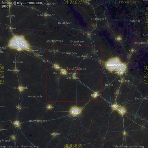
» NASA city lights 2003
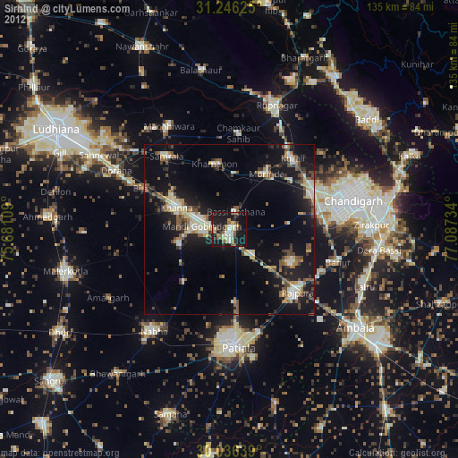
» Earth at Night: Flat Maps 2012, 2016