Kharar night lights from space
Night Light of Kharar (Punjab) from space (India) Src. Average luminocity for 10x10km area is 74.7517% and for 50x50km: 42.9577%.
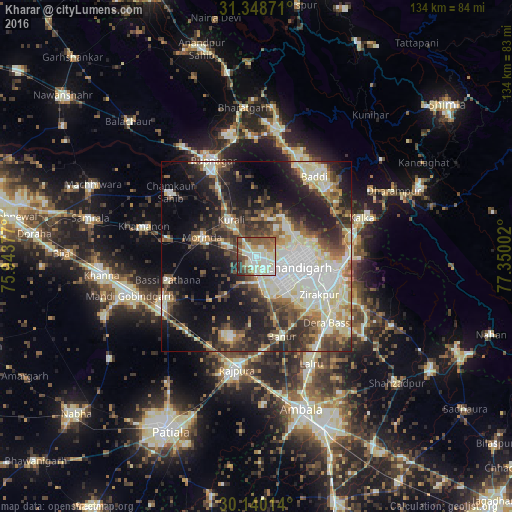
Analysis of Kharar night lights 2016
Square area 10x10 km:
 15.56%
90-99
22.55%80-89
14.69%70-79
4.9%60-69
7.17%50-59
19.93%40-49
7.69%30-39
4.2%20-29
3.32%10-19
0%0-9
0%Square area 50x50 km:
7.87%90-99
10.05%80-89
6.42%70-79
3.2%60-69
4.58%50-59
6.05%40-49
6.52%30-39
7.39%20-29
10.32%10-19
16.52%0-9
21.09%Clear (daylight) street map image can be seen on geolist.org.
Map coordinates:
31° 20' 55.4" North, 75° 56' 37.6" East
30° 44' 46.8" North, 76° 38' 48.8" East
30° 8' 24.5" North, 77° 21' 0.1" East
Some cities around Kharar sort by population:
• Chandigarh
13.6 km =8.5 mi,  94°
94°
• Panchkula
20.3 km =12.6 mi,  106°
106°
• Mohali
10.3 km =6.4 mi,  135°
135°
• Pinjaur
26.6 km =16.5 mi,  77°
77°
• Morinda
15 km =9.3 mi,  289°
289°
• Basi
25.9 km =16.1 mi,  132°
132°
• Basi
24.4 km =15.2 mi,  254°
254°
• Banūr
22.5 km =14 mi,  162°
162°
1266960 (p: 45,691)
Sources (retrieved 2019-11-25):
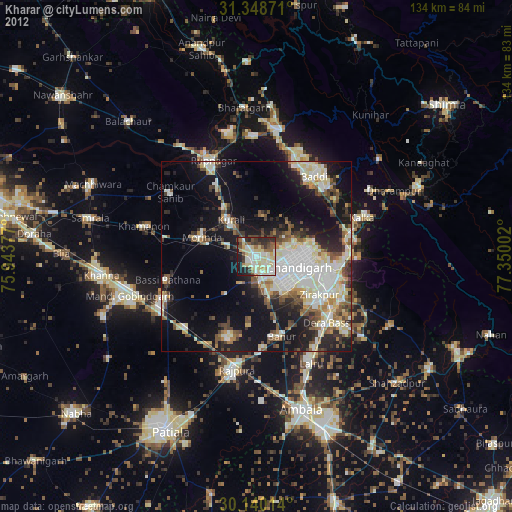
» Earth at Night: Flat Maps 2012, 2016