Shōranūr night lights from space
Night Light of Shōranūr (Kerala) from space (India) Src. Average luminocity for 10x10km area is 2.1219% and for 50x50km: 2.6891%.
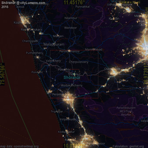
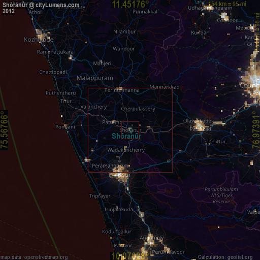
Analysis of Shōranūr night lights 2016
Square area 10x10 km:
 0%
0%90-99
0%80-89
0%70-79
0%60-69
0%50-59
0.83%40-49
1.45%30-39
1.86%20-29
0.83%10-19
0%0-9
95.04%Square area 50x50 km:
0.01%90-99
0.09%80-89
0.22%70-79
0.43%60-69
0.46%50-59
0.77%40-49
0.74%30-39
0.69%20-29
1.08%10-19
1.85%0-9
93.66%Clear (daylight) street map image can be seen on geolist.org.
Map coordinates:
11° 27' 6.3" North, 75° 34' 3.6" East
10° 45' 42.5" North, 76° 16' 14.8" East
10° 4' 13" North, 76° 58' 26.1" East
Some cities around Shōranūr sort by population:
• Thrissur
27.9 km =17.3 mi,  192°
192°
• Kunnamkulam
25.7 km =16 mi,  240°
240°
• Mannārakkāt
33.2 km =20.6 mi,  39°
39°
• Ottappālam
11.7 km =7.3 mi,  83°
83°
• Chetwayi
35.6 km =22.1 mi,  223°
223°
• Cherpulassery
13.4 km =8.3 mi,  18°
18°
• Guruvāyūr
31.3 km =19.4 mi,  233°
233°
• Chēlakara
11.1 km =6.9 mi,  133°
133°
1256432 (p: 42,694)
Sources (retrieved 2019-11-25):
» Earth at Night: Flat Maps 2012, 2016