Mannārakkāt night lights from space
Night Light of Mannārakkāt (Kerala) from space (India) Src. Average luminocity for 10x10km area is 0.8506% and for 50x50km: 1.4732%.
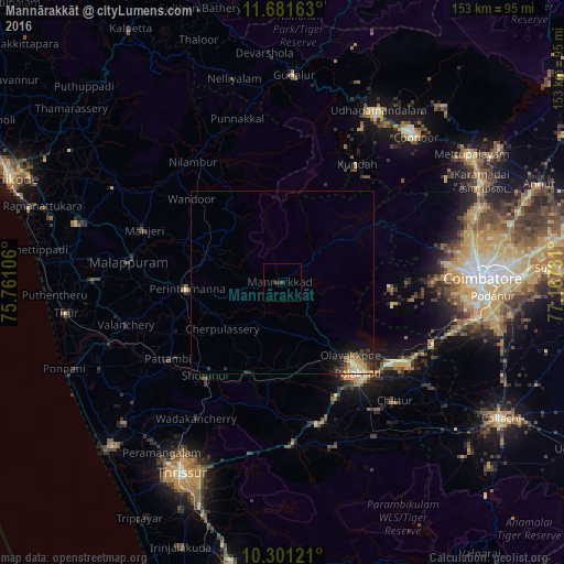
Analysis of Mannārakkāt night lights 2016
Square area 10x10 km:
 0%
0%90-99
0%80-89
0%70-79
0%60-69
0%50-59
0%40-49
0%30-39
1.95%20-29
0.65%10-19
0%0-9
97.4%Square area 50x50 km:
0.01%90-99
0.24%80-89
0.26%70-79
0.31%60-69
0.08%50-59
0.26%40-49
0.18%30-39
0.47%20-29
0.48%10-19
0.91%0-9
96.8%Clear (daylight) street map image can be seen on geolist.org.
Map coordinates:
11° 40' 53.9" North, 75° 45' 39.8" East
10° 59' 32" North, 76° 27' 51" East
10° 18' 4.4" North, 77° 10' 2.3" East
Some cities around Mannārakkāt sort by population:
• Pālghāt
32 km =19.9 mi,  139°
139°
• Manjeri
40.2 km =25 mi,  290°
290°
• Malappuram
42.1 km =26.2 mi,  277°
277°
• Ottappālam
26.1 km =16.2 mi,  201°
201°
• Shōranūr
33.2 km =20.6 mi,  219°
219°
• Chittūr
44.9 km =27.9 mi, 136°
• Cherpulassery
21.2 km =13.2 mi,  232°
232°
• Chēlakara
35.8 km =22.2 mi, 201°
1263661 (p: 50,921)
Sources (retrieved 2019-11-25):
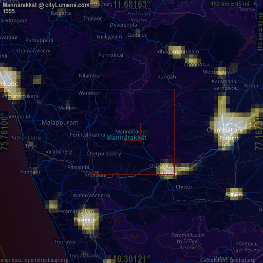
» NASA, Earths city lights 1995
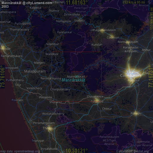
» NASA city lights 2003
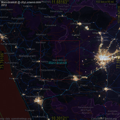
» Earth at Night: Flat Maps 2012, 2016