Shīshgarh night lights from space
Night Light of Shīshgarh (Uttar Pradesh) from space (India) Src. Average luminocity for 10x10km area is 9.6818% and for 50x50km: 15.4828%.
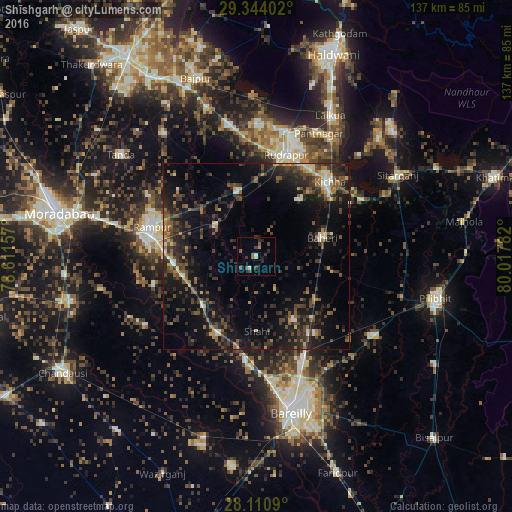
Analysis of Shīshgarh night lights 2016
Square area 10x10 km:
 0%
0%90-99
1.52%80-89
0.57%70-79
0.19%60-69
0.95%50-59
2.84%40-49
3.03%30-39
3.22%20-29
3.79%10-19
1.33%0-9
82.58%Square area 50x50 km:
0.63%90-99
1.15%80-89
1.28%70-79
1.09%60-69
1.77%50-59
3.09%40-49
4.37%30-39
4.58%20-29
7.24%10-19
13.68%0-9
61.12%Clear (daylight) street map image can be seen on geolist.org.
Map coordinates:
29° 20' 38.5" North, 78° 36' 41.7" East
28° 43' 45.4" North, 79° 18' 52.9" East
28° 6' 39.2" North, 80° 1' 4.2" East
Some cities around Shīshgarh sort by population:
• Baheri
18.5 km =11.5 mi,  74°
74°
• Bīlāspur
18 km =11.2 mi,  346°
346°
• Milak
19.3 km =12 mi,  226°
226°
• Kemrī
13.7 km =8.5 mi,  308°
308°
• Deoraniān
19.3 km =12 mi,  125°
125°
• Richha
20.7 km =12.9 mi,  100°
100°
• Shāhi
19.9 km =12.4 mi,  179°
179°
• Shergarh
10.1 km =6.3 mi,  148°
148°
1256468 (p: 23,471)
Sources (retrieved 2019-11-25):
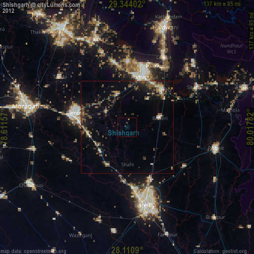
» Earth at Night: Flat Maps 2012, 2016