Shāhābād night lights from space
Night Light of Shāhābād (Haryana) from space (India) Src. Average luminocity for 10x10km area is 36.3094% and for 50x50km: 23.5726%.
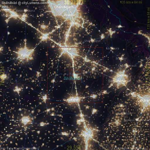
Analysis of Shāhābād night lights 2016
Square area 10x10 km:
 2.97%
2.97%90-99
6.47%80-89
5.59%70-79
2.45%60-69
3.85%50-59
2.97%40-49
7.87%30-39
8.57%20-29
20.63%10-19
32.87%0-9
5.77%Square area 50x50 km:
2.43%90-99
3.89%80-89
2.87%70-79
1.36%60-69
2.04%50-59
3.47%40-49
5.33%30-39
6.48%20-29
9.63%10-19
16.92%0-9
45.58%Clear (daylight) street map image can be seen on geolist.org.
Map coordinates:
30° 46' 25.6" North, 76° 10' 2.4" East
30° 10' 3.9" North, 76° 52' 13.7" East
29° 33' 28.8" North, 77° 34' 24.9" East
Some cities around Shāhābād sort by population:
• Ambāla
22.6 km =14 mi,  342°
342°
• Thānesar
21.9 km =13.6 mi,  189°
189°
• Pehowa
34.8 km =21.6 mi,  232°
232°
• Lādwa
25.7 km =16 mi,  138°
138°
• Indri
36.8 km =22.9 mi,  150°
150°
• Radaur
31.3 km =19.4 mi,  120°
120°
• Mustafābād
27 km =16.8 mi,  81°
81°
• Ghanaur
30.7 km =19.1 mi,  306°
306°
1256752 (p: 39,323)
Sources (retrieved 2019-11-25):
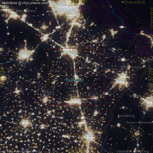
» Earth at Night: Flat Maps 2012, 2016