Thānesar night lights from space
Night Light of Thānesar (Haryana) from space (India) Src. Average luminocity for 10x10km area is 60.5379% and for 50x50km: 19.2398%.
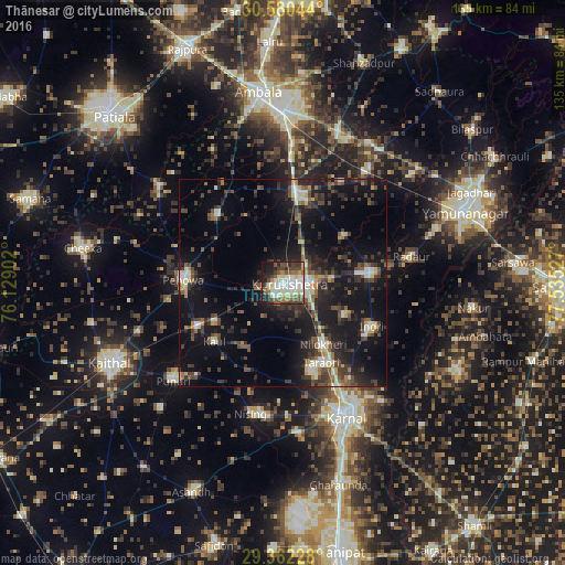
Analysis of Thānesar night lights 2016
Square area 10x10 km:
 12.5%
12.5%90-99
17.05%80-89
7.95%70-79
4.92%60-69
4.55%50-59
8.71%40-49
13.07%30-39
9.47%20-29
11.36%10-19
9.47%0-9
0.95%Square area 50x50 km:
1.46%90-99
2.99%80-89
1.82%70-79
1.37%60-69
1.67%50-59
2.64%40-49
4.55%30-39
5.11%20-29
7.09%10-19
19.1%0-9
52.22%Clear (daylight) street map image can be seen on geolist.org.
Map coordinates:
30° 34' 49.6" North, 76° 7' 44.5" East
29° 58' 23.6" North, 76° 49' 55.7" East
29° 21' 44.2" North, 77° 32' 7" East
Some cities around Thānesar sort by population:
• Karnāl
34.6 km =21.5 mi,  154°
154°
• Shāhābād
21.9 km =13.6 mi,  9°
9°
• Pehowa
24.1 km =15 mi,  271°
271°
• Lādwa
20.7 km =12.9 mi,  83°
83°
• Pūndri
35.3 km =21.9 mi,  227°
227°
• Nīlokheri
18 km =11.2 mi, 147°
• Indri
24.3 km =15.1 mi,  115°
115°
• Radaur
31.4 km =19.5 mi, 78°
1254657 (p: 138,279)
Sources (retrieved 2019-11-25):
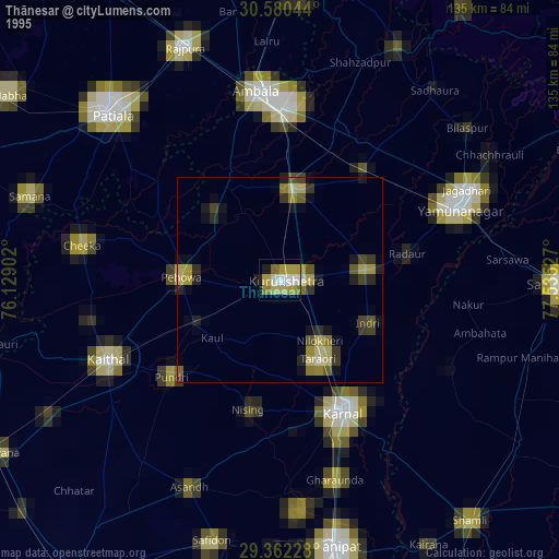
» NASA, Earths city lights 1995
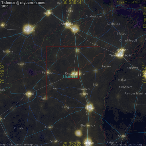
» NASA city lights 2003
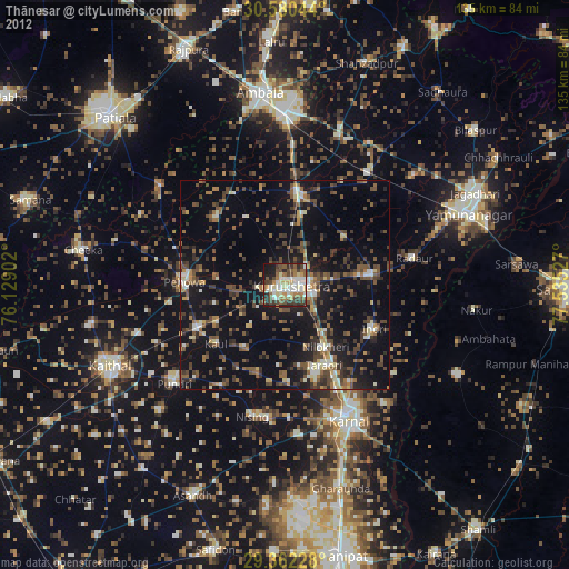
» Earth at Night: Flat Maps 2012, 2016