Ambāla night lights from space
Night Light of Ambāla (Haryana) from space (India) Src. Average luminocity for 10x10km area is 87.0623% and for 50x50km: 32.8148%.
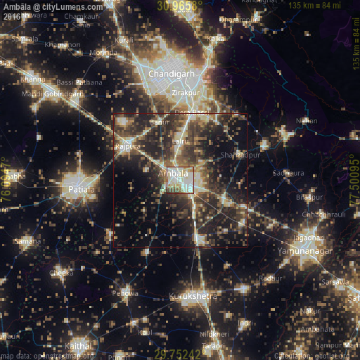
Analysis of Ambāla night lights 2016
Square area 10x10 km:
 25.64%
90-99
35.35%80-89
16.3%70-79
5.31%60-69
5.49%50-59
5.49%40-49
3.85%30-39
1.83%20-29
0.73%10-19
0%0-9
0%Square area 50x50 km:
2.62%90-99
5.42%80-89
4.47%70-79
2.53%60-69
3.83%50-59
6.02%40-49
8.46%30-39
9.52%20-29
13.93%10-19
14.33%0-9
28.87%Clear (daylight) street map image can be seen on geolist.org.
Map coordinates:
30° 57' 56.9" North, 76° 5' 40.9" East
30° 21' 39.6" North, 76° 47' 52.2" East
29° 45' 8.7" North, 77° 30' 3.4" East
Some cities around Ambāla sort by population:
• Mohali
36.2 km =22.5 mi,  348°
348°
• Rājpura
23.6 km =14.7 mi,  303°
303°
• Shāhābād
22.6 km =14 mi,  162°
162°
• Narāyangarh
34.2 km =21.3 mi,  67°
67°
• Basi
25.7 km =16 mi,  10°
10°
• Sanaur
33.3 km =20.7 mi,  258°
258°
• Banūr
22.7 km =14.1 mi,  340°
340°
• Ghanaur
18.1 km =11.2 mi, 259°
1278860 (p: 146,787)
Sources (retrieved 2019-11-25):
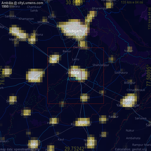
» NASA, Earths city lights 1995
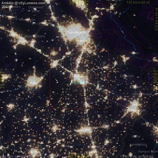
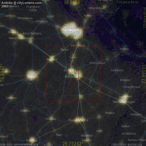
» NASA city lights 2003
» Earth at Night: Flat Maps 2012, 2016