Seram night lights from space
Night Light of Seram (Karnataka) from space (India) Src. Average luminocity for 10x10km area is 31.9959% and for 50x50km: 12.5253%.
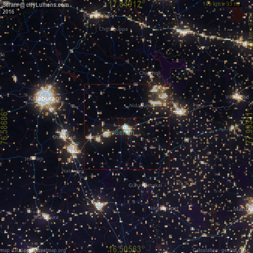
Analysis of Seram night lights 2016
Square area 10x10 km:
 5.99%
5.99%90-99
6.82%80-89
2.07%70-79
1.65%60-69
3.1%50-59
4.34%40-49
5.17%30-39
3.31%20-29
8.47%10-19
39.88%0-9
19.21%Square area 50x50 km:
1.09%90-99
1.56%80-89
1.02%70-79
0.87%60-69
1.86%50-59
2.16%40-49
2.58%30-39
2.66%20-29
4.07%10-19
10.19%0-9
71.94%Clear (daylight) street map image can be seen on geolist.org.
Map coordinates:
17° 50' 56.8" North, 76° 35' 12.7" East
17° 10' 42.9" North, 77° 17' 23.9" East
16° 30' 20.3" North, 77° 59' 35.2" East
Some cities around Seram sort by population:
• Yādgīr
48.2 km =30 mi,  199°
199°
• Tāndūr
31.5 km =19.6 mi,  75°
75°
• Shāhābād
37.2 km =23.1 mi,  261°
261°
• Wādi
34.8 km =21.6 mi,  246°
246°
• Chītāpur
22.9 km =14.2 mi, 254°
• Chincholi
34.7 km =21.6 mi,  23°
23°
• Gurmatkāl
36.2 km =22.5 mi,  162°
162°
• Kurgunta
7.4 km =4.6 mi, 77°
1256814 (p: 35,134)
Sources (retrieved 2019-11-25):
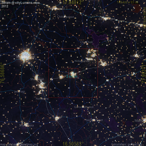
» Earth at Night: Flat Maps 2012, 2016