Chītāpur night lights from space
Night Light of Chītāpur (Karnataka) from space (India) Src. Average luminocity for 10x10km area is 21.9004% and for 50x50km: 14.2661%.
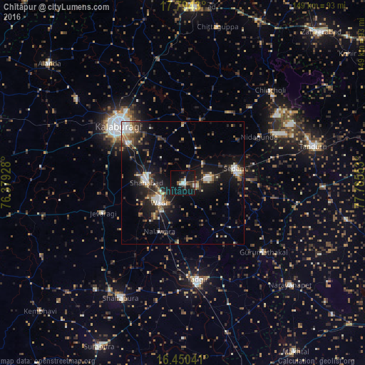
Analysis of Chītāpur night lights 2016
Square area 10x10 km:
 1.95%
1.95%90-99
4.98%80-89
0%70-79
0%60-69
2.6%50-59
4.98%40-49
3.46%30-39
3.25%20-29
3.68%10-19
38.96%0-9
36.15%Square area 50x50 km:
1.85%90-99
2.02%80-89
1.27%70-79
0.92%60-69
1.67%50-59
2.28%40-49
2.12%30-39
3.26%20-29
4.21%10-19
13.05%0-9
67.36%Clear (daylight) street map image can be seen on geolist.org.
Map coordinates:
17° 47' 39.5" North, 76° 22' 45.4" East
17° 7' 24.9" North, 77° 4' 56.6" East
16° 27' 1.5" North, 77° 47' 7.9" East
Some cities around Chītāpur sort by population:
• Gulbarga
35.1 km =21.8 mi,  312°
312°
• Yādgīr
39.7 km =24.7 mi,  171°
171°
• Shāhābād
14.8 km =9.2 mi,  273°
273°
• Seram
22.9 km =14.2 mi,  74°
74°
• Wādi
12.6 km =7.8 mi,  230°
230°
• Jevargi
35.1 km =21.8 mi,  249°
249°
• Gurmatkāl
43.4 km =27 mi,  130°
130°
• Kurgunta
30.3 km =18.8 mi,  75°
75°
1274077 (p: 30,139)
Sources (retrieved 2019-11-25):
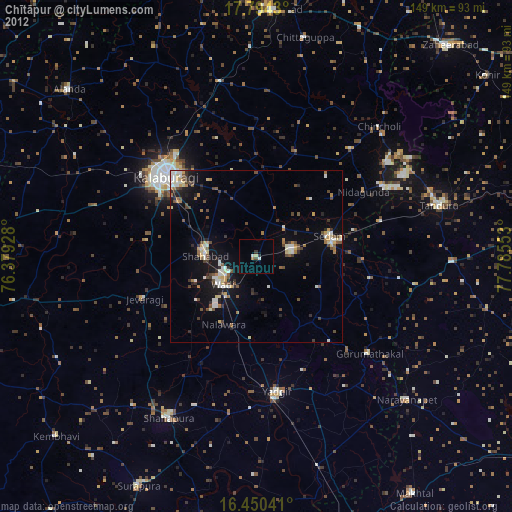
» Earth at Night: Flat Maps 2012, 2016