Satrikh night lights from space
Night Light of Satrikh (Uttar Pradesh) from space (India) Src. Average luminocity for 10x10km area is 31.8512% and for 50x50km: 34.8679%.
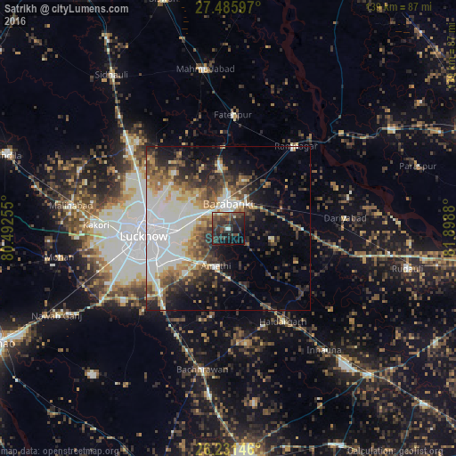
Analysis of Satrikh night lights 2016
Square area 10x10 km:
 0.79%
0.79%90-99
1.98%80-89
2.18%70-79
0.6%60-69
1.59%50-59
5.16%40-49
19.64%30-39
16.27%20-29
23.02%10-19
17.26%0-9
11.51%Square area 50x50 km:
7.48%90-99
8.92%80-89
2.67%70-79
3.37%60-69
4.11%50-59
4.18%40-49
5.78%30-39
5.71%20-29
7.65%10-19
10.11%0-9
40.01%Clear (daylight) street map image can be seen on geolist.org.
Map coordinates:
27° 29' 9.5" North, 80° 29' 33.2" East
26° 51' 37.6" North, 81° 11' 44.4" East
26° 13' 53.3" North, 81° 53' 55.7" East
Some cities around Satrikh sort by population:
• Lucknow
27.1 km =16.8 mi,  265°
265°
• Nawābganj
7.9 km =4.9 mi,  1°
1°
• Fatehpur
34.8 km =21.6 mi, 2°
• Zaidpur
13.7 km =8.5 mi,  103°
103°
• Dewā
19.7 km =12.2 mi,  351°
351°
• Rāmnagar
32.5 km =20.2 mi,  39°
39°
• Nagrām
27.4 km =17 mi,  191°
191°
• Goshāīnganj
13.5 km =8.4 mi,  220°
220°
1257005 (p: 11,023)
Sources (retrieved 2019-11-25):
» Earth at Night: Flat Maps 2012, 2016