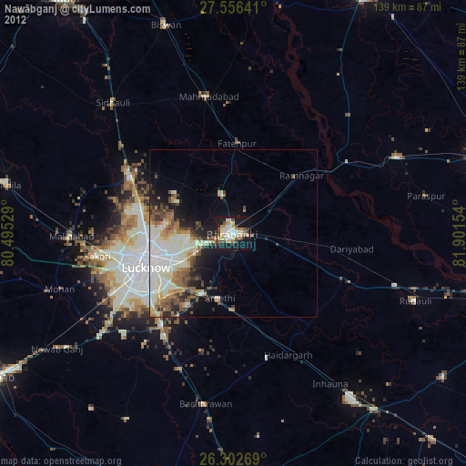
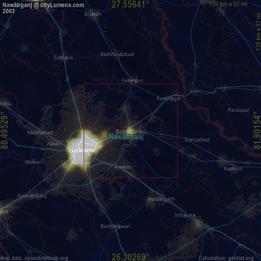
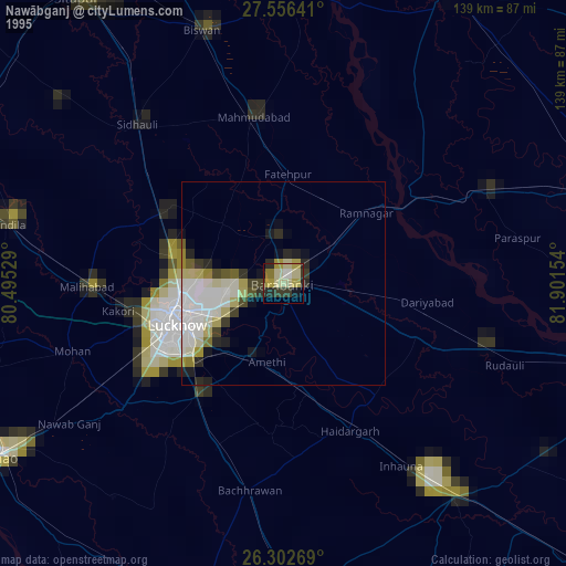
Nawābganj night lights from space
Night Light of Nawābganj (Uttar Pradesh) from space (India) Src. Average luminocity for 10x10km area is 70.2321% and for 50x50km: 32.5715%.
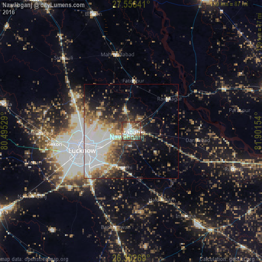
Analysis of Nawābganj night lights 2016
Square area 10x10 km:
 11.11%
90-99
24.8%80-89
8.73%70-79
3.37%60-69
10.32%50-59
13.1%40-49
18.85%30-39
7.34%20-29
2.38%10-19
0%0-9
0%Square area 50x50 km:
7.04%90-99
8.51%80-89
2.52%70-79
3.27%60-69
3.94%50-59
3.75%40-49
5.12%30-39
5.32%20-29
6.66%10-19
8.78%0-9
45.1%Clear (daylight) street map image can be seen on geolist.org.
Map coordinates:
27° 33' 23.1" North, 80° 29' 43" East
26° 55' 52.6" North, 81° 11' 54.3" East
26° 18' 9.7" North, 81° 54' 5.5" East
Some cities around Nawābganj sort by population:
• Lucknow
29.2 km =18.1 mi,  249°
249°
• Fatehpur
26.9 km =16.7 mi,  2°
2°
• Zaidpur
17.1 km =10.6 mi,  130°
130°
• Dewā
12.1 km =7.5 mi,  345°
345°
• Rāmnagar
26.7 km =16.6 mi,  50°
50°
• Satrikh
7.9 km =4.9 mi,  181°
181°
• Goshāīnganj
20.3 km =12.6 mi,  206°
206°
• Itaunja
34.3 km =21.3 mi,  299°
299°
1261641 (p: 79,246)
Sources (retrieved 2019-11-25):
» NASA, Earths city lights 1995
» NASA city lights 2003
» Earth at Night: Flat Maps 2012, 2016