Nagrām night lights from space
Night Light of Nagrām (Uttar Pradesh) from space (India) Src. Average luminocity for 10x10km area is 13.9261% and for 50x50km: 24.1627%.
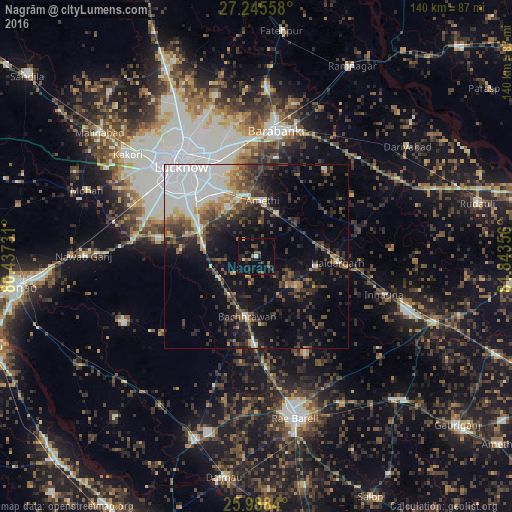
Analysis of Nagrām night lights 2016
Square area 10x10 km:
 0.38%
0.38%90-99
0.38%80-89
0.95%70-79
0.57%60-69
1.89%50-59
3.79%40-49
2.84%30-39
3.79%20-29
5.49%10-19
4.17%0-9
75.76%Square area 50x50 km:
4.91%90-99
4.69%80-89
1.44%70-79
2.07%60-69
2.29%50-59
3.26%40-49
4.49%30-39
4.94%20-29
6.47%10-19
12.04%0-9
53.4%Clear (daylight) street map image can be seen on geolist.org.
Map coordinates:
27° 14' 44.1" North, 80° 26' 14.3" East
26° 37' 7.4" North, 81° 8' 25.5" East
25° 59' 18.2" North, 81° 50' 36.8" East
Some cities around Nagrām sort by population:
• Lucknow
32.7 km =20.3 mi,  318°
318°
• Nawābganj
35.2 km =21.9 mi,  9°
9°
• Zaidpur
30.1 km =18.7 mi,  38°
38°
• Maurānwān
33.4 km =20.8 mi,  230°
230°
• Bachhrāwān
16.6 km =10.3 mi,  188°
188°
• Satrikh
27.4 km =17 mi, 11°
• Goshāīnganj
16.9 km =10.5 mi,  348°
348°
• Mahārājganj
29.6 km =18.4 mi,  153°
153°
1262168 (p: 9,858)
Sources (retrieved 2019-11-25):
» Earth at Night: Flat Maps 2012, 2016