Lucknow night lights from space
Night Light of Lucknow (Uttar Pradesh) from space (India) Src. Average luminocity for 10x10km area is 99.871% and for 50x50km: 56.5787%.
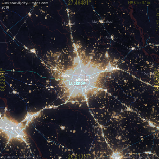

Analysis of Lucknow night lights 2016
Square area 10x10 km:
 89.48%
90-99
10.52%80-89
0%70-79
0%60-69
0%50-59
0%40-49
0%30-39
0%20-29
0%10-19
0%0-9
0%Square area 50x50 km:
14.14%90-99
16.33%80-89
5.01%70-79
5.83%60-69
6.17%50-59
6.72%40-49
7.67%30-39
7.66%20-29
9.25%10-19
12.48%0-9
8.73%Clear (daylight) street map image can be seen on geolist.org.
Map coordinates:
27° 27' 53.7" North, 80° 13' 12" East
26° 50' 21.4" North, 80° 55' 23.3" East
26° 12' 36.6" North, 81° 37' 34.5" East
Some cities around Lucknow sort by population:
• Nawābganj
29.2 km =18.1 mi,  69°
69°
• Kākori
14 km =8.7 mi,  283°
283°
• Malīhābād
23 km =14.3 mi,  293°
293°
• Mohān
25.5 km =15.8 mi,  255°
255°
• Dewā
32.6 km =20.3 mi,  47°
47°
• Satrikh
27.1 km =16.8 mi,  85°
85°
• Goshāīnganj
19.9 km =12.4 mi,  113°
113°
• Itaunja
27.3 km =17 mi,  354°
354°
1264733 (p: 2,472,011)
Sources (retrieved 2019-11-25):
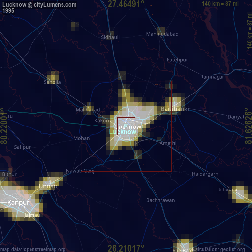
» NASA, Earths city lights 1995
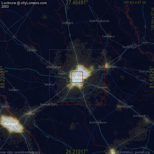
» NASA city lights 2003
» Earth at Night: Flat Maps 2012, 2016