Fatehpur night lights from space
Night Light of Fatehpur (Uttar Pradesh) from space (India) Src. Average luminocity for 10x10km area is 7.5739% and for 50x50km: 10.1853%.
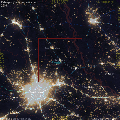
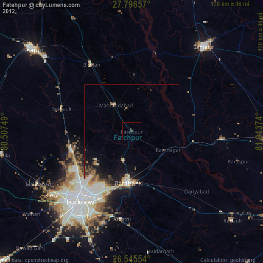
Analysis of Fatehpur night lights 2016
Square area 10x10 km:
 0.76%
0.76%90-99
0.76%80-89
1.52%70-79
1.14%60-69
0.19%50-59
0.57%40-49
2.08%30-39
0.38%20-29
2.08%10-19
1.52%0-9
89.02%Square area 50x50 km:
0.47%90-99
1.06%80-89
1.04%70-79
1.3%60-69
1.79%50-59
2%40-49
2.31%30-39
2.85%20-29
3.98%10-19
5.33%0-9
77.87%Clear (daylight) street map image can be seen on geolist.org.
Map coordinates:
27° 47' 47.7" North, 80° 30' 27" East
27° 10' 22.1" North, 81° 12' 38.2" East
26° 32' 43.9" North, 81° 54' 49.5" East
Some cities around Fatehpur sort by population:
• Nawābganj
26.9 km =16.7 mi,  182°
182°
• Mahmudābād
16.1 km =10 mi,  325°
325°
• Sidhaulī
39.1 km =24.3 mi,  288°
288°
• Jarwal
32.8 km =20.4 mi,  91°
91°
• Dewā
15.8 km =9.8 mi,  195°
195°
• Rāmnagar
21.6 km =13.4 mi,  116°
116°
• Satrikh
34.8 km =21.6 mi, 182°
• Itaunja
32.6 km =20.3 mi,  252°
252°
1271911 (p: 34,010)
Sources (retrieved 2019-11-25):
» Earth at Night: Flat Maps 2012, 2016