Saktī night lights from space
Night Light of Saktī (Chhattisgarh) from space (India) Src. Average luminocity for 10x10km area is 41.6091% and for 50x50km: 22.9096%.
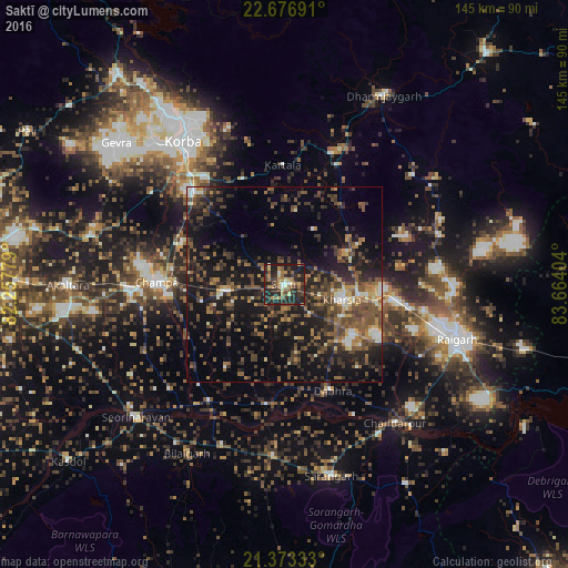
Analysis of Saktī night lights 2016
Square area 10x10 km:
 1.59%
1.59%90-99
4.76%80-89
4.37%70-79
6.94%60-69
8.33%50-59
8.53%40-49
6.55%30-39
13.1%20-29
27.78%10-19
18.06%0-9
0%Square area 50x50 km:
1.04%90-99
2%80-89
1.51%70-79
2.47%60-69
3.21%50-59
5.82%40-49
6.72%30-39
5.88%20-29
9.35%10-19
19.8%0-9
42.2%Clear (daylight) street map image can be seen on geolist.org.
Map coordinates:
22° 40' 36.9" North, 82° 15' 28" East
22° 1' 35.8" North, 82° 57' 39.3" East
21° 22' 24" North, 83° 39' 50.5" East
Some cities around Saktī sort by population:
• Korba
44.7 km =27.8 mi,  322°
322°
• Raigarh
47.2 km =29.3 mi,  107°
107°
• Chāmpa
32.8 km =20.4 mi,  271°
271°
• Jānjgīr
39.5 km =24.5 mi, 267°
• Kharsia
15.4 km =9.6 mi, 105°
• Sārangarh
50.5 km =31.4 mi,  166°
166°
• Kharod
50.4 km =31.3 mi,  231°
231°
• Gharghoda
43.5 km =27 mi,  67°
67°
1257673 (p: 21,561)
Sources (retrieved 2019-11-25):
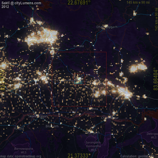
» Earth at Night: Flat Maps 2012, 2016