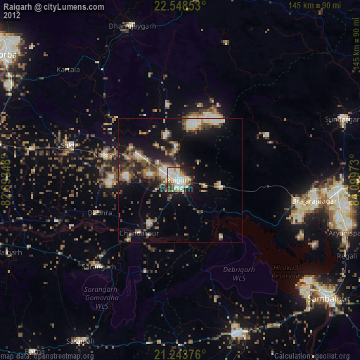
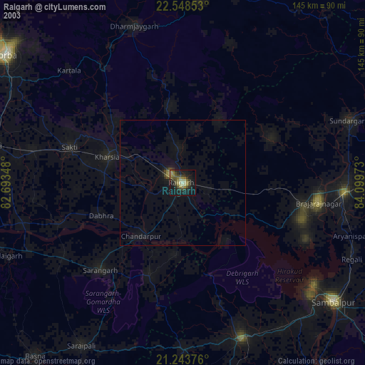
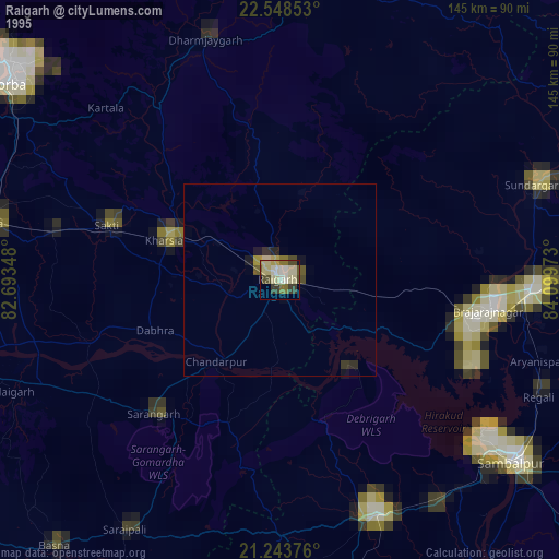
Raigarh night lights from space
Night Light of Raigarh (Chhattisgarh) from space (India) Src. Average luminocity for 10x10km area is 82.004% and for 50x50km: 27.6829%.
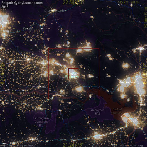
Analysis of Raigarh night lights 2016
Square area 10x10 km:
 29.17%
90-99
29.37%80-89
3.97%70-79
8.33%60-69
10.52%50-59
5.36%40-49
7.14%30-39
2.58%20-29
3.57%10-19
0%0-9
0%Square area 50x50 km:
3.48%90-99
4.46%80-89
2.06%70-79
2.52%60-69
2.99%50-59
5.79%40-49
6.24%30-39
6.9%20-29
9.18%10-19
18.9%0-9
37.47%Clear (daylight) street map image can be seen on geolist.org.
Map coordinates:
22° 32' 54.7" North, 82° 41' 36.5" East
21° 53' 51.5" North, 83° 23' 47.8" East
21° 14' 37.5" North, 84° 5' 59" East
Some cities around Raigarh sort by population:
• Jharsuguda
63.2 km =39.3 mi,  94°
94°
• Brājarājnagar
54.4 km =33.8 mi,  99°
99°
• Burla
65.4 km =40.6 mi,  131°
131°
• Hīrākud
64.3 km =40 mi, 130°
• Saktī
47.2 km =29.3 mi,  287°
287°
• Kharsia
31.8 km =19.8 mi, 288°
• Sārangarh
47.7 km =29.6 mi,  223°
223°
• Gharghoda
31.1 km =19.3 mi,  351°
351°
1259005 (p: 121,278)
Sources (retrieved 2019-11-25):
» NASA, Earths city lights 1995
» NASA city lights 2003
» Earth at Night: Flat Maps 2012, 2016